
Hollister Ranch
Santa Barbara · Santa Barbara County · California

Did you dive today?Please share the visibility to make our algorithm more accurate.
Report visibilityToday's forecast
Updated 10:00 AM PT today · July 28, 2026Dawn is the clearest window — onshore wind picks up by late morning and surface chop stirs the bottom through the afternoon.
7-Day Forecast
Map · getting there
34.470° N · 120.325° W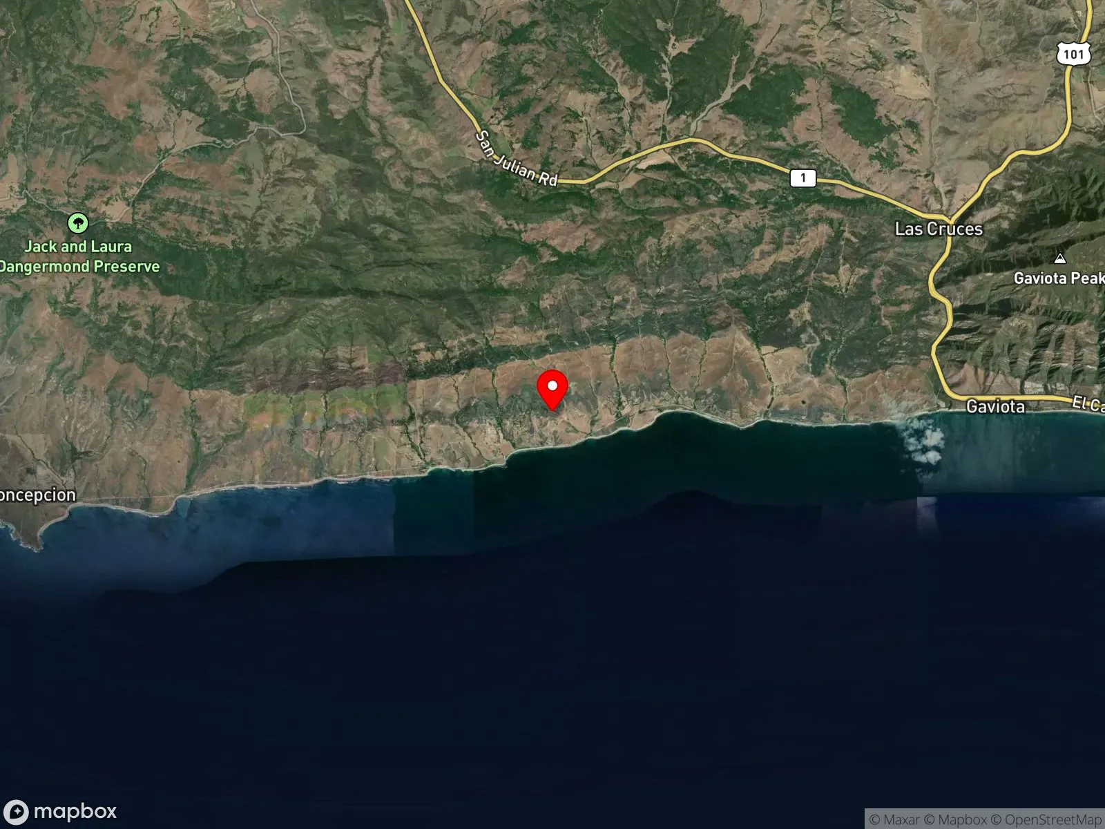
About Hollister Ranch
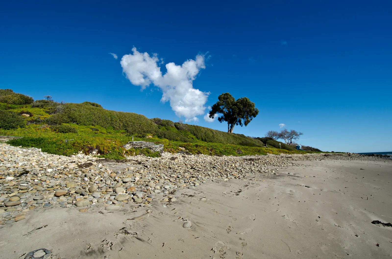
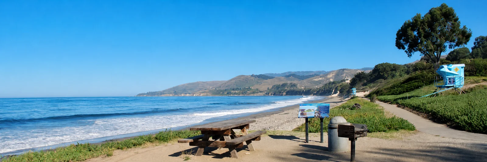
Hollister Ranch is a 14,500-acre gated subdivision on the Gaviota Coast west of Santa Barbara, with 8.5 miles of private coastline ending at Point Conception. Most people who know the name know it only by reputation. The ranch is divided into 136 parcels, the smallest sellable share is one-sixteenth, and the country club fee runs roughly the cost of a new car each year. A single access gate at the eastern end near Gaviota leads to an hour of winding dirt roads to reach a house only 8 miles from the gate as the crow flies. Cows wander the roads, mountain lions and deer move through the hills, and the beaches stay mostly empty.
The coastline holds 8 named surf breaks, but only 3 are considered worthwhile, and only one of those is consistent by Santa Barbara standards, which works out to roughly 50 surfable days a year. The Channel Islands shadow the coast from the south, so south swells only get in when they carry a strong west angle, which happens once or twice a summer. North swells need a specific angle to wrap into the breaks, and most of the winter season is flat between large pulses. When conditions do line up, the takeoff zones are small and crowded with locals, and the social scene in the water can be hostile. Boating in is legally permitted, but residents tend to snake every wave and harass outside surfers until they leave. The reef under the surf breaks is covered in urchins and exposes at low tide.
Because public land access has been blocked for decades, the coastline gets almost no fishing pressure compared to the rest of the Santa Barbara Channel. That history has left fish populations well above what open-coast spots elsewhere in the channel typically show, which is the practical draw for boat-based spearfishing and rod-and-reel fishing off the ranch.
Three biomes apply along the 8.5-mile coastline. The open sandy sections below the named surf breaks are a surf zone biome of sand bottom and breaking waves. The urchin-covered reef structure under and between the breaks, bare hard bottom distinct from the offshore kelp, is a rocky reef biome. Farther out, giant kelp anchors to the rock and grows up through the water column to the surface, forming an extensive kelp band visible from the bluff, the kelp forest biome.
Access is the defining problem. The ranch is private, and beach access by land is restricted to homeowners, parcel owners, and their guests. California's public-access mandate AB1680, passed in 2019, requires the state to open coastal access along Hollister Ranch, but as of 2026 the program is still in environmental review and not implemented. Boat access to the water is legally allowed, though in practice the surf breaks are policed socially by residents, and the experience for an outside boater is rarely worth it. No public parking or public land entry exists.
Legality splits at the western tip. The waters around the western end of the ranch, near Point Conception, sit inside Point Conception SMR, where take is prohibited. East of that boundary, along the rest of the 8.5-mile coast, fishing and spearfishing are legal under standard California regulations.

Surf Zone
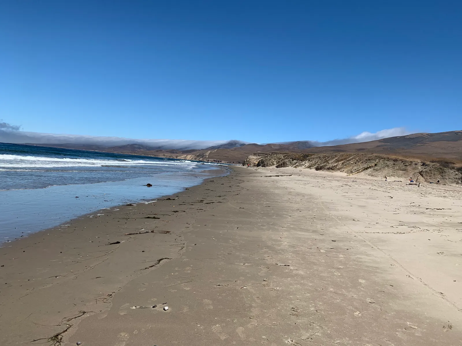
The surf zone biome consists of sandy beaches and breaking waves. The action of surf disturbing the sand and kicking it up exposes marine invertebrates, buried in their shallow dens. This natural exposure of invertebrates attracts all kinds of fish, looking for an easy meal. Learn more about this biome and the species found in it by clicking the link below.
Learn more in the Biome Glossary
Rocky Reef
The rocky reef biome is bare rock, boulder, and cobble structure without a kelp canopy above it. The hard relief and its crevices shelter invertebrates and reef fish, and the structure concentrates life that the surrounding sand cannot hold. Learn more about this biome and the species found in it by clicking the link below.
Learn more in the Biome Glossary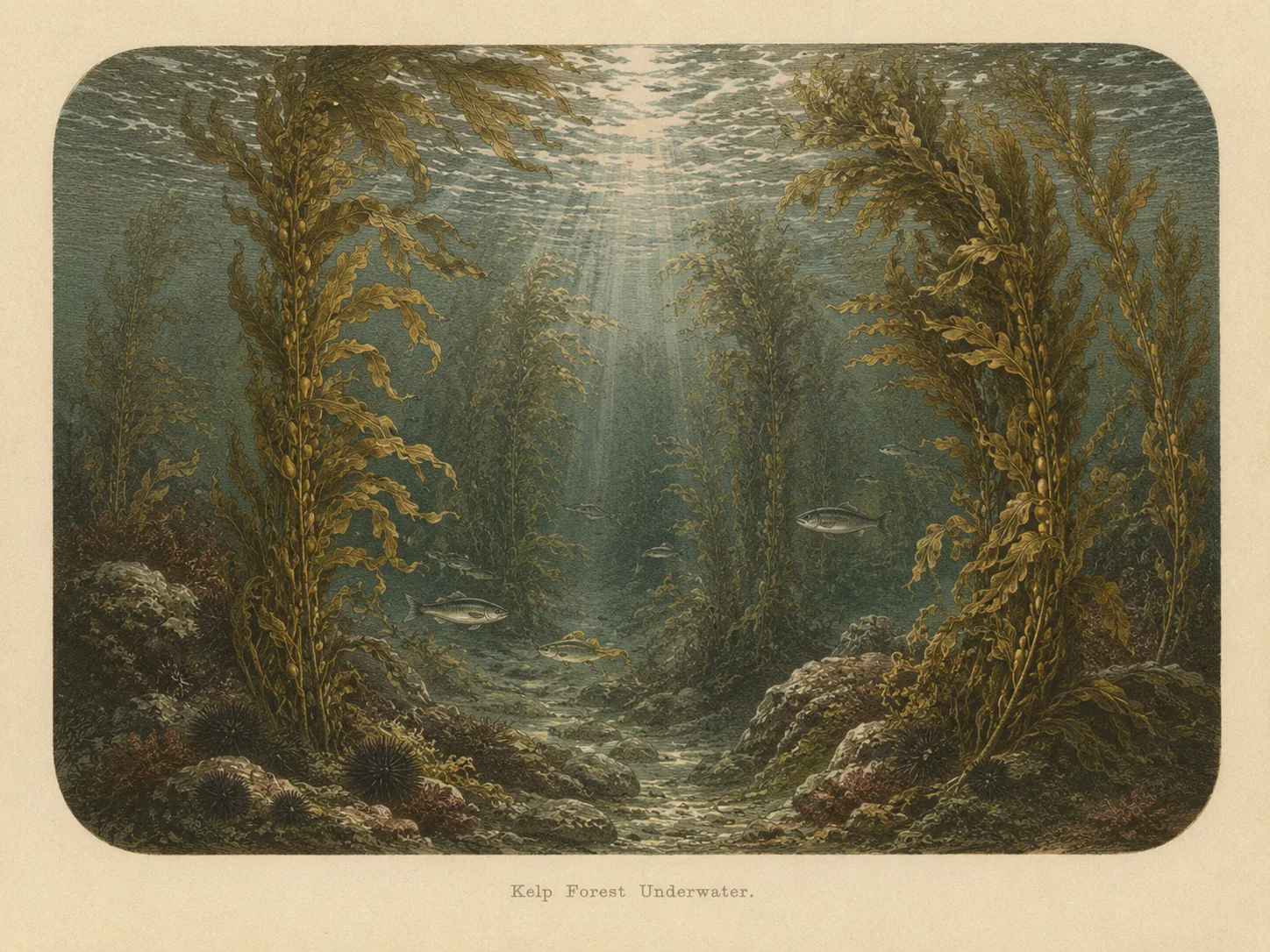
Kelp Forest
The kelp forest biome is giant kelp anchored to rocky bottom and growing up through the water column. The canopy and stipes form a three-dimensional habitat that shelters fish, invertebrates, and the predators that hunt them. Learn more about this biome and the species found in it by clicking the link below.
Learn more in the Biome GlossaryTarget Fish Species
Nearby beaches
Gain the Power
of the Oracle.
Ocean Oracle sees the future. Get 7-day visibility forecasts for every beach, plus alerts the night before clarity peaks — so you never miss a prime day.
Free shows you what the ocean looks like today. Ocean Oracle shows you the week ahead and the fish waiting for you down there.
Visibility predictions for the entire week ahead at any beach. Plan dives, schedule charters, book trips — without guessing.
The night before any beach hits prime conditions, Ocean Oracle pings your phone. Wake up knowing exactly where to go.
Track your favorite beaches in one place. Forecasts and alerts for everywhere you dive.
For every beach: what species are there, when they show up, and how to target them. Built by spearos, for spearos.
See the future. Dive on the right days.