
 Ocean Oracle Pro
See the Future.
Dive on the Right Days.
Ocean Oracle gives spearfishermen and divers everything the free site holds back: 7-day visibility forecasts, watchlist alerts, the Pelagiscape offshore map, the full Dive Log, members-only spot strategies, a front-page Oracle section on the Coastal Bulletin, and a completely ad-free experience.
No guessing. No missed windows.
7-Day Visibility Forecasts
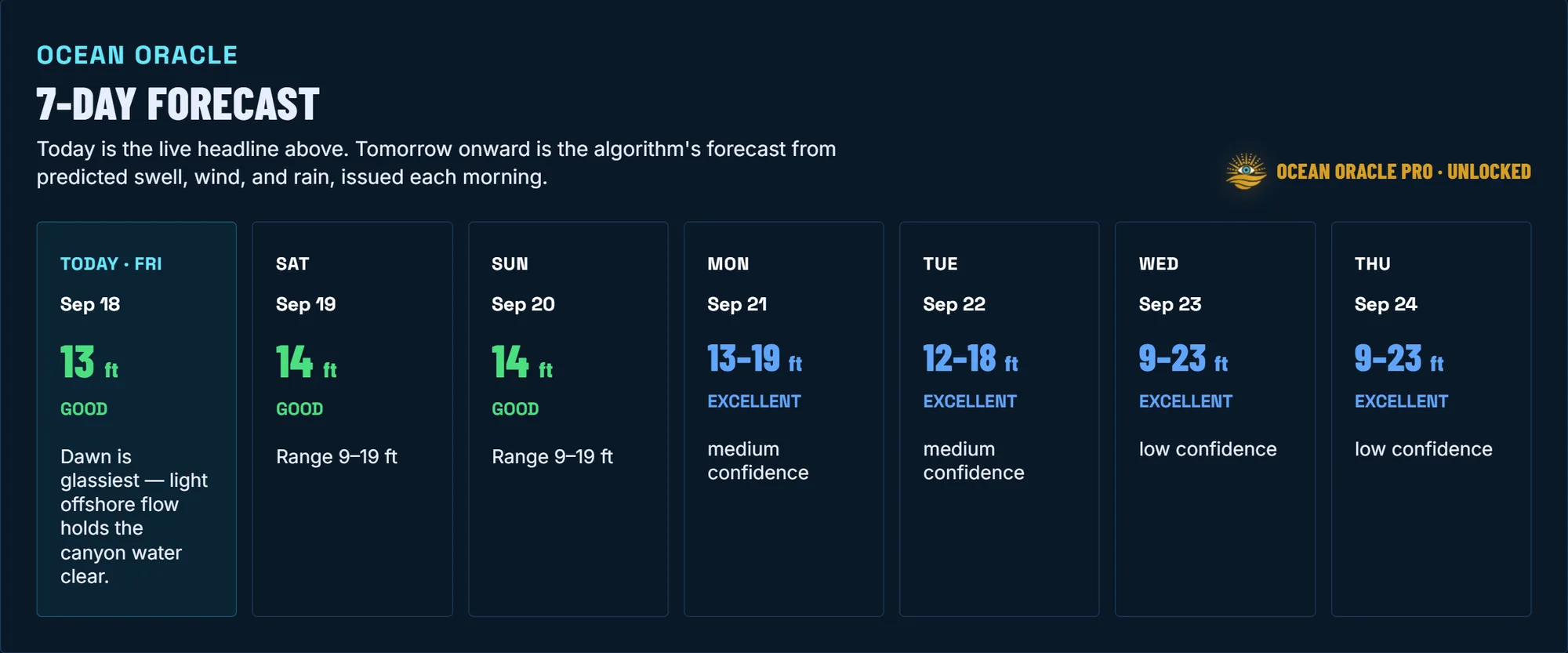
Free shows you today. Ocean Oracle runs the same visibility engine 7 days out for every beach on the site, so you can plan dives, charters, and trips around the water instead of your calendar.
Every day carries its own tier, range, and confidence rating, so you know when to trust a call and when to check back as the day gets closer.
Pelagiscape
Pelagiscape is one full-screen map of the water off all of California, from the Mexican border to the Oregon border, including the islands and the offshore banks. It lays the newest satellite maps of water clarity and sea temperature over seafloor shading, depth lines in feet, surface kelp, Marine Protected Areas, surface currents, wind, and swell.
It traces temperature breaks and the lines where green water meets blue, and slides back through the last 7 days. Tap anywhere on the water for the depth, temperature, clarity, current, and wind at that spot.
Save your spots as private pins, share one with a dive buddy, and get an email when a temperature break or green-to-blue line comes within 10 miles of them. Anyone can open the water clarity map from at least 2 days before the newest one. It is for planning only, not navigation.
Open Pelagiscape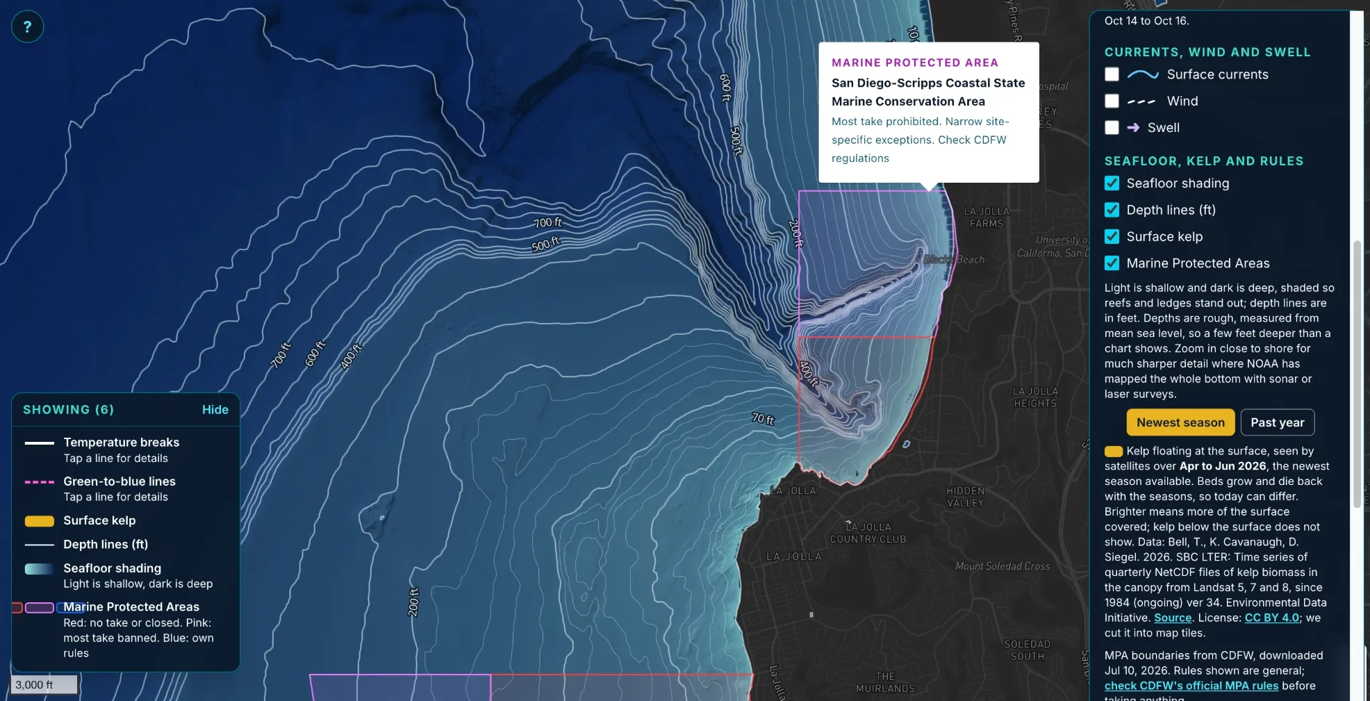
La Jolla with seafloor shading, depth lines in feet, and Marine Protected Areas. Light water is shallow and dark is deep, and tapping a protected area shows its name and rules.
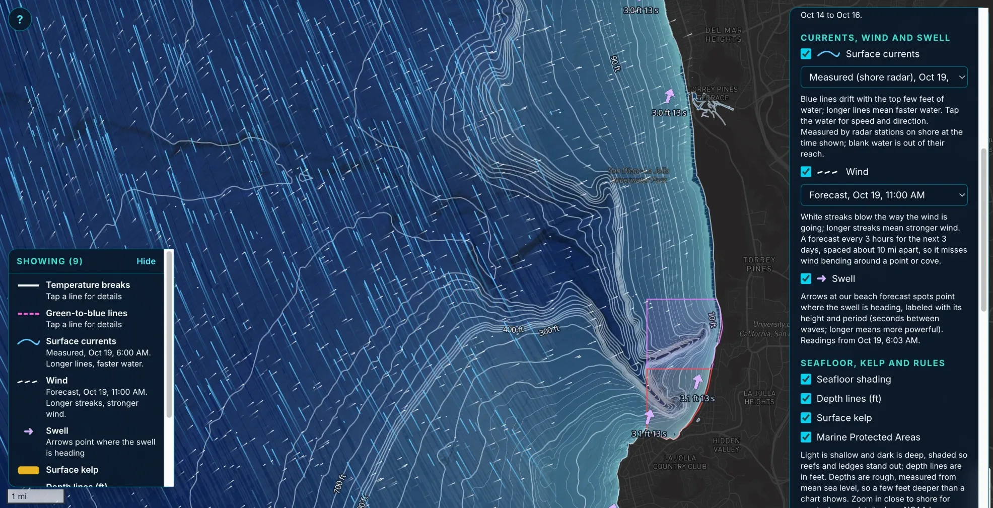
The same stretch of La Jolla with currents, wind, and swell turned on. Blue lines drift with the surface current, white streaks blow with the wind, and the arrows show where the swell is heading with its height and period.
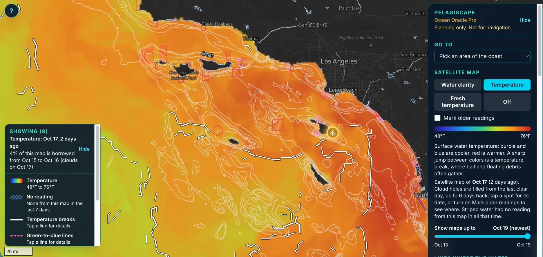
The satellite temperature map across Southern California and the Channel Islands. Blue and purple are cooler and red is warmer, and the white lines trace temperature breaks, where bait and floating debris often gather.
View more Pelagiscape photos (4)Hide the extra photos
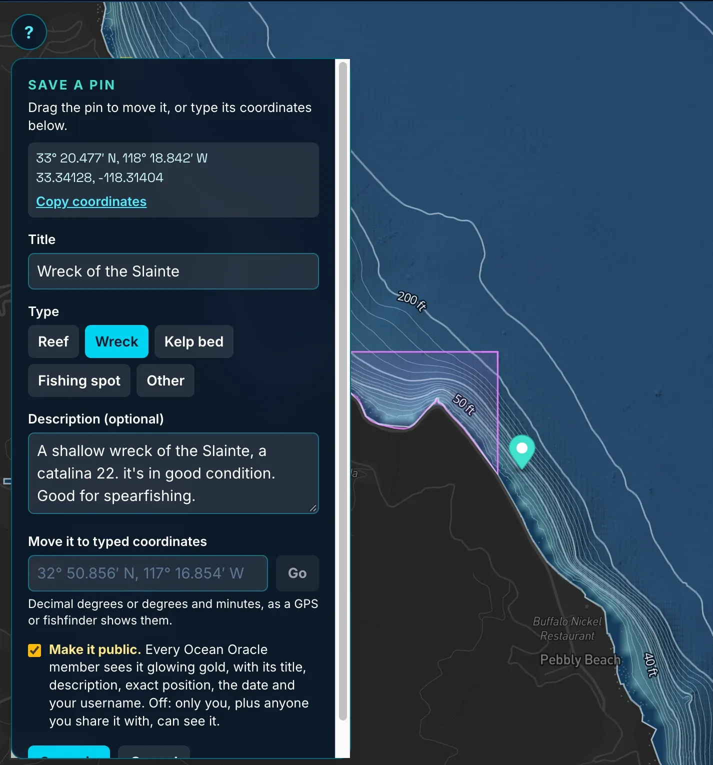
Saving a pin. Give it a title and a type, add a description, and drag it into place or type the coordinates straight from a GPS or fishfinder. Pins stay private unless you make them public.
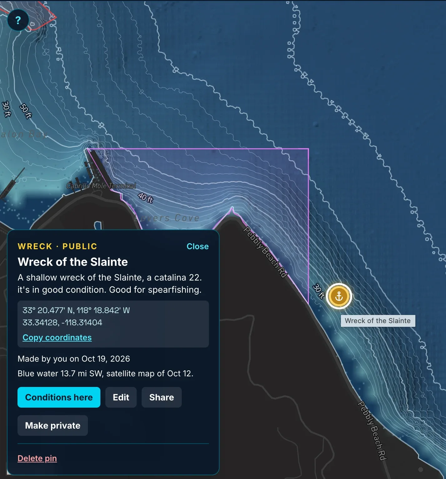
A saved pin. It keeps the exact coordinates ready to copy, tells you how far the nearest blue water sits on the latest satellite map, and opens the conditions at that spot.
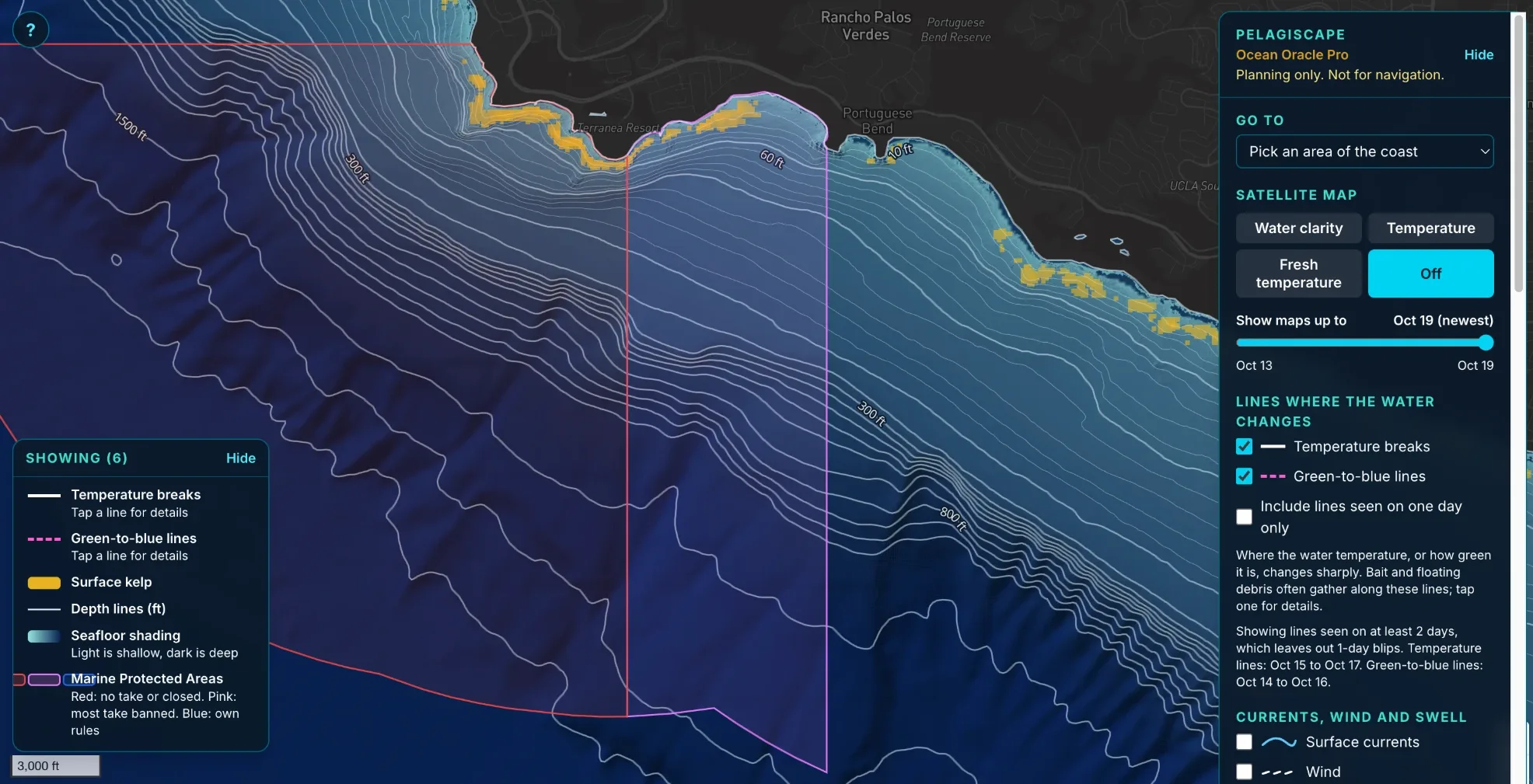
Palos Verdes with surface kelp turned on. The gold patches are kelp floating at the surface, seen by satellite over the newest season, next to the outlines of the local Marine Protected Areas.
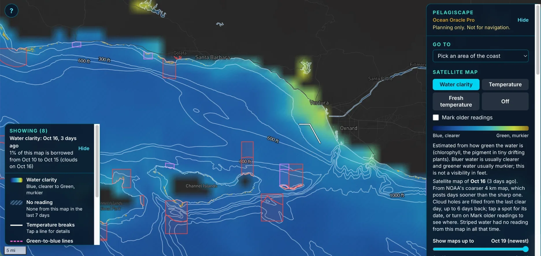
The water clarity map off Santa Barbara and Ventura. It is estimated from how green the water is: bluer water is usually clearer and greener water is usually murkier.
Watchlists and Alerts
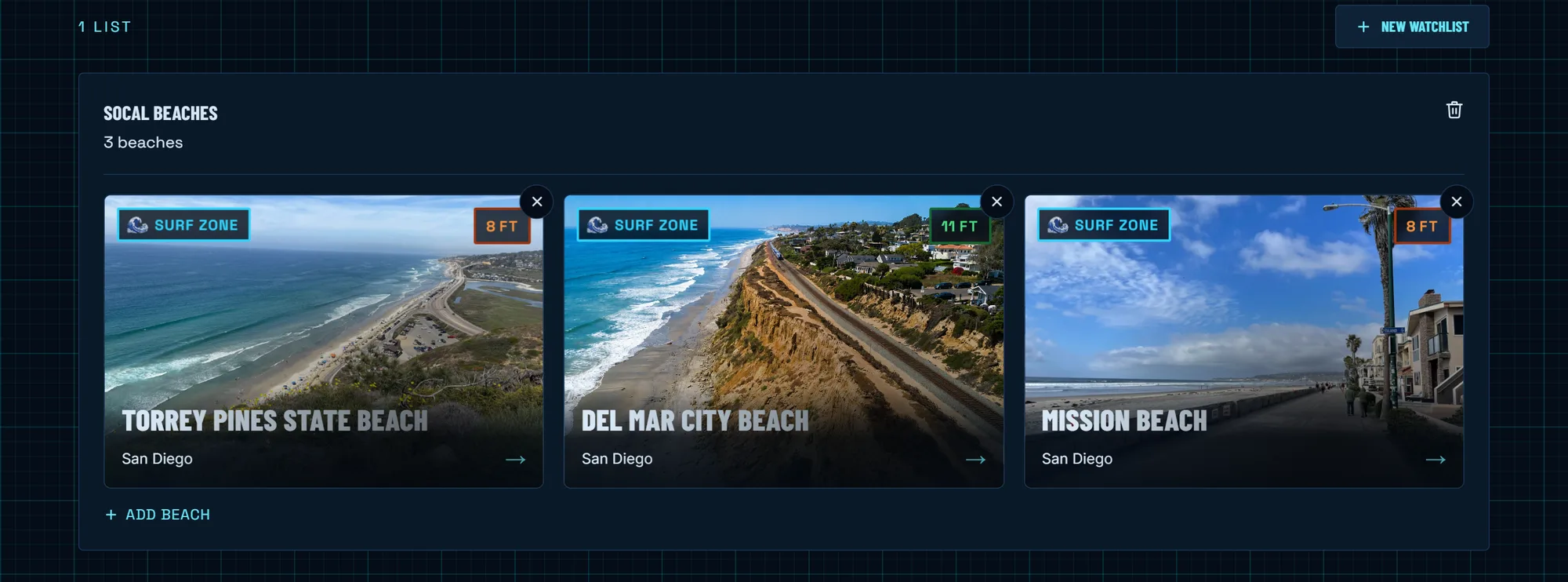
Build watchlists of the beaches you actually dive, from the watchlists page or the bookmark button on any beach, and Ocean Oracle keeps watch. Set your own number for a beach, or use the automatic one, and you get an email the moment it is reached today, plus a one-time heads-up when the 7-day forecast sees a good day coming.
A prime window never slips past you.
The Dive Log
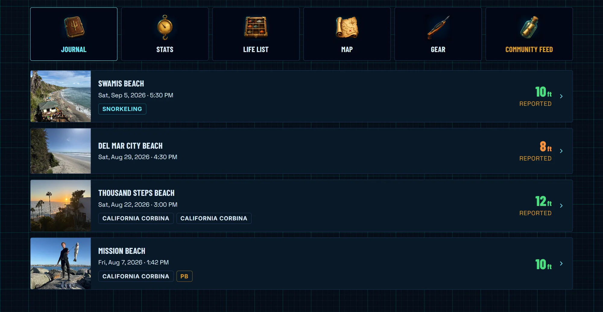
Log a session and the Dive Log freezes that day’s visibility report inside the entry: the forecast number, tide, swell, wind, and water temperature, exactly as the report read when you dove. The ocean that day is saved forever, alongside your catches, photos, and the story.
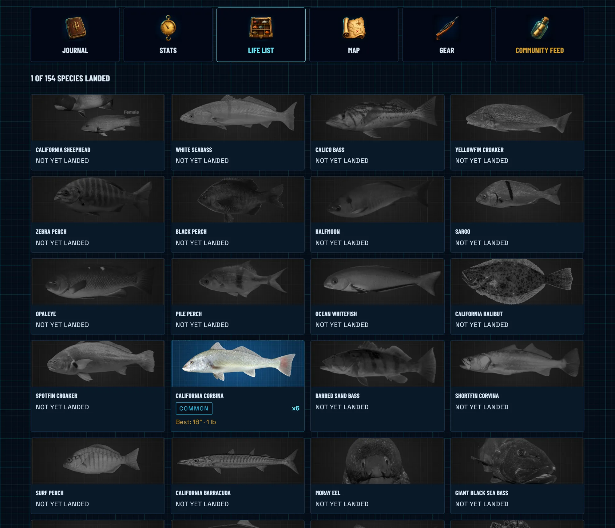
Every fish is logged by species with length, weight, photos, and the gun that took it. Beat your own record for a species and the fish gets a permanent gold Personal Best stamp. Your named weapons earn XP for every tagged fish and climb a tier every 10 levels, from Greenhorn all the way to Poseidon’s Trident.
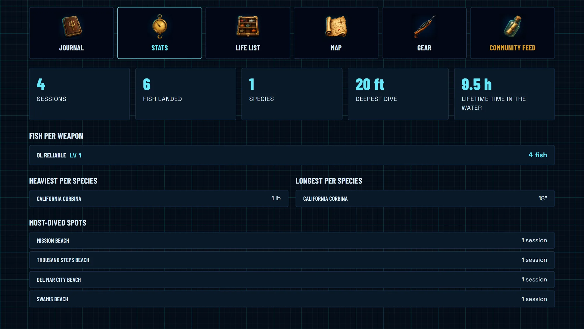
A life list lights up every Ichthyopedia species you have landed, your stats and records build themselves, and a personal dive map fills in with every spot you have logged. Entries stay private unless you choose to share them to the community feed.
Spot Strategies
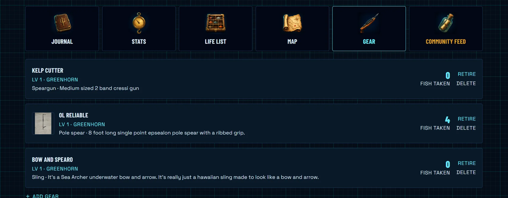
Every beach where taking fish is legal carries a members-only strategy board. Members post how they actually hunt the spot: the biome they worked, the gear, the tide, the season, the time of day, and the species they were after, with photos.
Heart the strategies that work, ask questions in the comments, and post your own to earn XP. None of it is visible outside the membership.
Front-Page Oracle
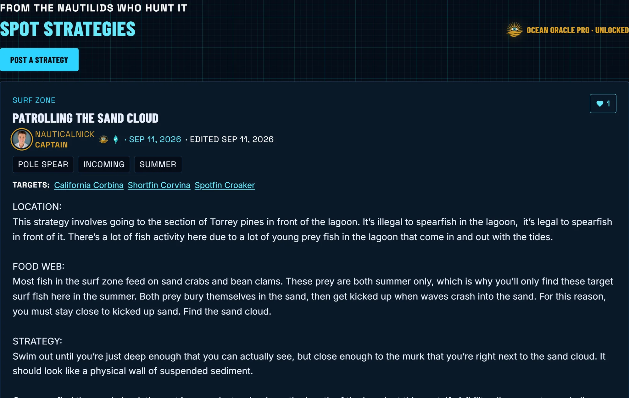
The Coastal Bulletin on the front page carries a gold Ocean Oracle section for members: the clearest water on the coast today, plus your own watchlist, with zero clicks to reach either.
Each watchlisted beach also calls out the best day coming in the week ahead, so the plan makes itself while you scan the morning board. And when spots are running Excellent or Perfect visibility, members see the day’s dive-conditions pin naming them.
No Ads
Nothing between you and the water. Ocean Oracle members browse every page ad-free.

Built by a Diver.
Backed by Divers.
Nautical Nick is fully independent. No media company, no investors, no ad network, and no data brokers. Your data is never sold. A single diver builds, runs, and personally pays for everything on this site.
The forecast is not free to produce. Satellite feeds, buoy and pier data, daily collection runs, and the servers that crunch it all cost real money every month. Ocean Oracle membership covers those bills. Members are the reason the site stays online and stays independent.
Membership also funds the work you will not find anywhere else: the Ichthyopedia, searching beaches by the fish that swim there, and spearfishing intel written for this coast. The Ichthyopedia and the fish list on every beach page are free for everyone.
The Nautical Nick Visibility Report works hard to make this the most accurate visibility reporting service by a wide margin. If you have found this service helpful, please consider supporting so that it can continue to run forever. The more supporters we get, the better the website becomes, and the more features come to the free site and to our Ocean Oracle Pro members.
Join Ocean Oracle
One subscription covers every beach on the site. Cancel any time.
Full access, billed month to month. Cancel any time.
Equivalent to $4.17/mo — $10 cheaper than paying monthly for a year.
Your Watchlists
Track the beaches you dive. Ocean Oracle monitors them and alerts you when a prime day is coming. Members can also open them any time from their account.