
La Jenelle Park
Port Hueneme · Ventura County · California

Did you dive today?Please share the visibility to make our algorithm more accurate.
Report visibilityToday's forecast
Updated 10:00 AM PT today · July 28, 2026Dawn is the clearest window — onshore wind picks up by late morning and surface chop stirs the bottom through the afternoon.
7-Day Forecast
Map · getting there
34.147° N · 119.213° W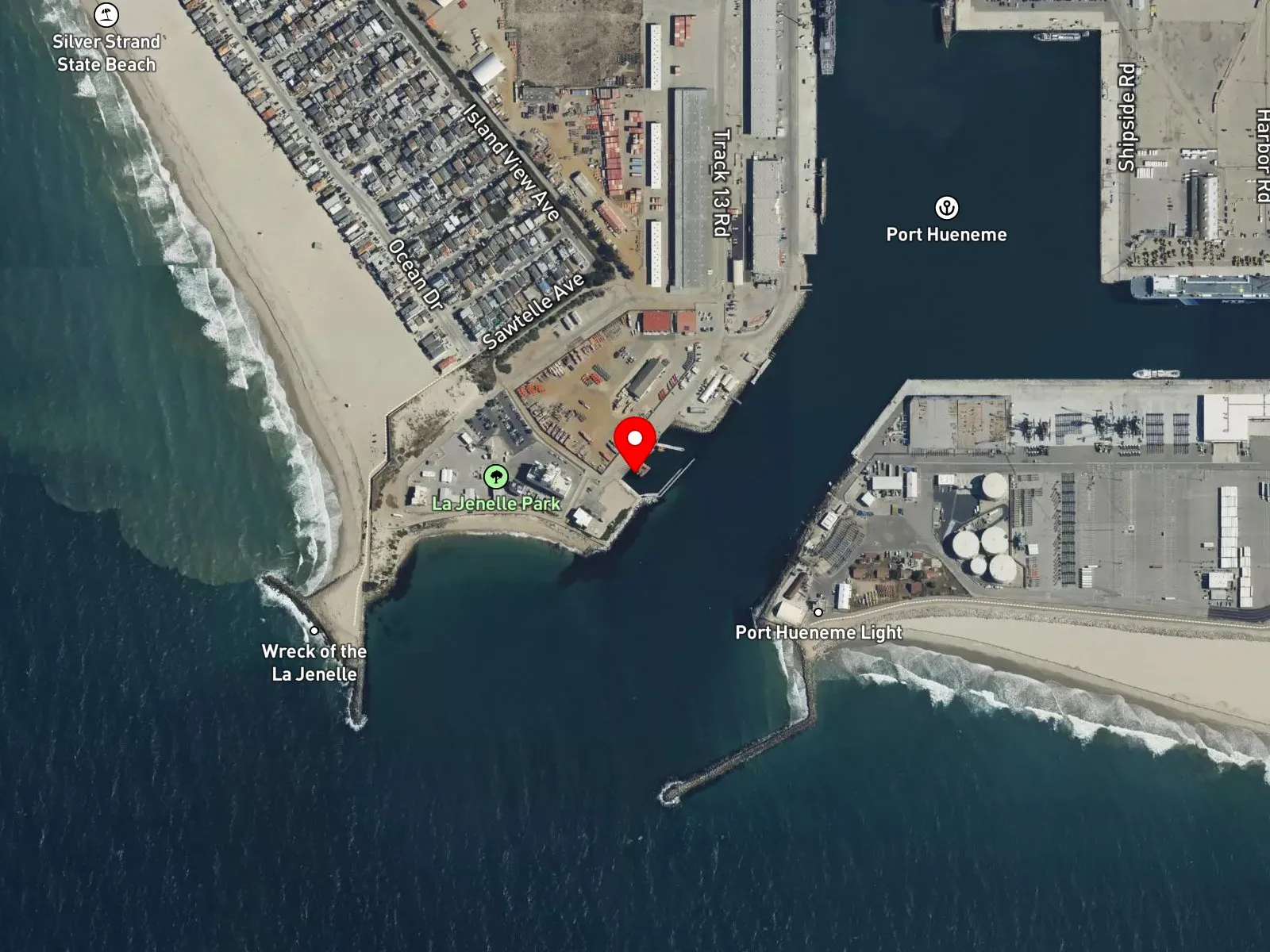
Port Hueneme, CA 93041
About La Jenelle Park
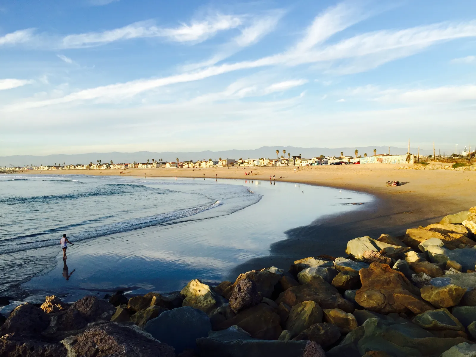
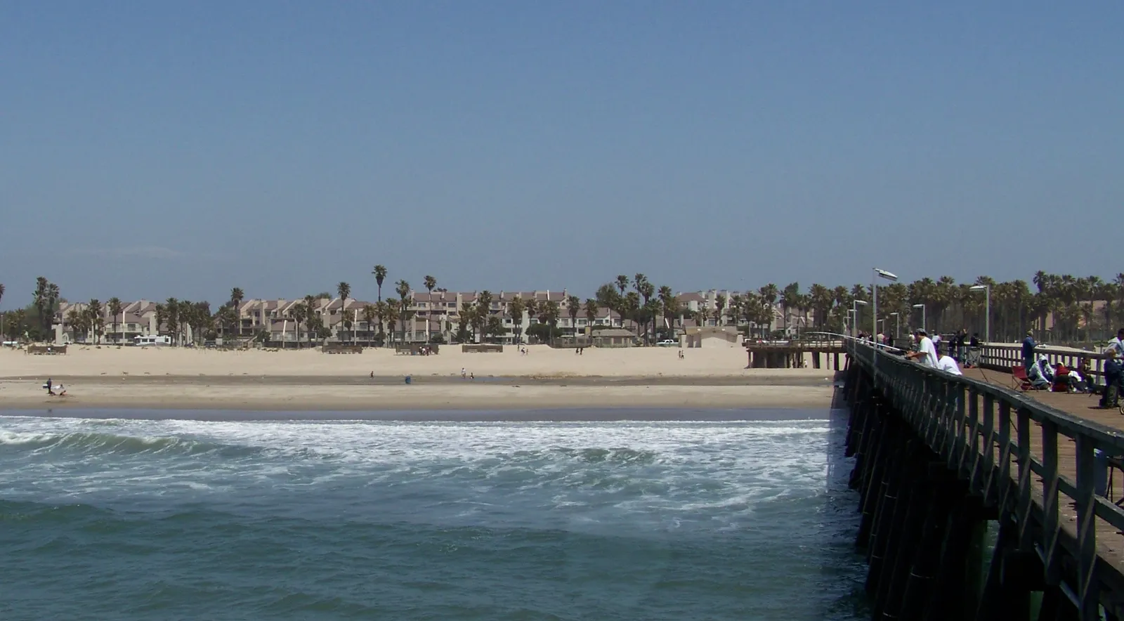
La Jenelle Park sits at the south end of Silver Strand Beach in Oxnard, at the Port of Hueneme north jetty. The park is built around the wreckage of the SS La Jenelle, a 1931 passenger liner originally launched as the SS Borinquen that was brought to Port Hueneme in 1969 for conversion to a floating casino. On April 13, 1970, the ship dragged its anchors in a northwest gale and ran aground at this location. The U.S. Navy dismantled the superstructure and incorporated the hull and surrounding boulders into the south jetty of the Port of Hueneme as a permanent breakwater. Today the park comprises the jetty, the wreckage, the murals along the access road, a commemorative plaque, and a small parking lot. Hueneme Submarine Canyon sits offshore of the jetty. La Jenelle Park is one of the standard Ventura County shore-dive sites for rocky structure access.
The sand entry adjacent to the jetty with breaking waves is a surf zone biome. At the breakwater itself, the artificial reef formed by the jetty boulders, the embedded hull remains, and the natural rocky structure is a rocky reef biome reached on foot at low tide and by short swim at higher tides.
Scuba on the jetty for the artificial reef and the wreckage is the dominant water activity. Fishing from the breakwater produces surfperch, and spearfishing at the jetty is common when conditions allow, with sheephead holding in the boulders. Snorkeling at the boulders at low tide is common, and surfing is uncommon at this spot because the jetty blocks open swell.
The small free lot at the end of Sawtelle Avenue holds roughly a dozen cars. There are no facilities on site, and the park closes at night per posted signage. Fishing and spearfishing are legal here under standard California regulations. The Port of Hueneme operates an active commercial deep-water port; posted closures should be observed, and the channel kept clear.

Surf Zone
The surf zone biome consists of sandy beaches and breaking waves. The action of surf disturbing the sand and kicking it up exposes marine invertebrates, buried in their shallow dens. This natural exposure of invertebrates attracts all kinds of fish, looking for an easy meal. Learn more about this biome and the species found in it by clicking the link below.
Learn more in the Biome Glossary
Rocky Reef
The rocky reef biome is bare rock, boulder, and cobble structure without a kelp canopy above it. The hard relief and its crevices shelter invertebrates and reef fish, and the structure concentrates life that the surrounding sand cannot hold. Learn more about this biome and the species found in it by clicking the link below.
Learn more in the Biome GlossaryTarget Fish Species
Nearby beaches
Gain the Power
of the Oracle.
Ocean Oracle sees the future. Get 7-day visibility forecasts for every beach, plus alerts the night before clarity peaks — so you never miss a prime day.
Free shows you what the ocean looks like today. Ocean Oracle shows you the week ahead and the fish waiting for you down there.
Visibility predictions for the entire week ahead at any beach. Plan dives, schedule charters, book trips — without guessing.
The night before any beach hits prime conditions, Ocean Oracle pings your phone. Wake up knowing exactly where to go.
Track your favorite beaches in one place. Forecasts and alerts for everywhere you dive.
For every beach: what species are there, when they show up, and how to target them. Built by spearos, for spearos.
See the future. Dive on the right days.