
Morro Rock Beach
San Luis Obispo · San Luis Obispo County · California

Did you dive today?Please share the visibility to make our algorithm more accurate.
Report visibilityToday's forecast
Updated 10:00 AM PT today · July 28, 2026Dawn is the clearest window — onshore wind picks up by late morning and surface chop stirs the bottom through the afternoon.
7-Day Forecast
Map · getting there
35.370° N · 120.865° W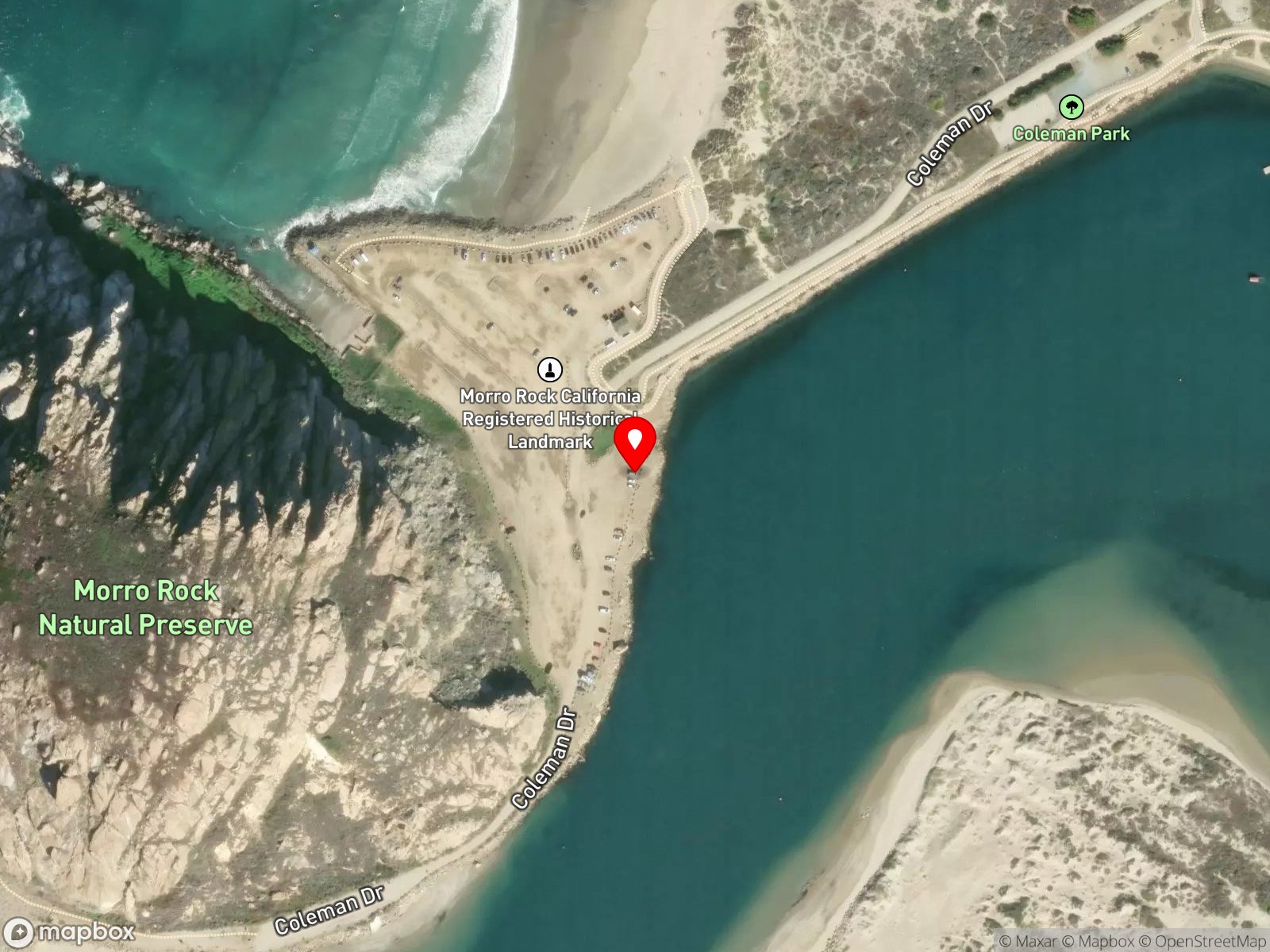
About Morro Rock Beach
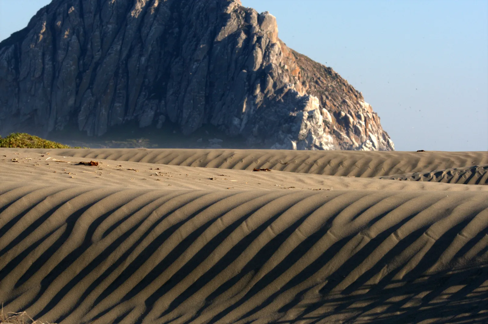
Morro Rock Beach is the open-ocean sand beach on the seaward side of Morro Rock, the 576-foot volcanic plug at the entrance to Morro Bay Harbor. The rock is the youngest and shortest of the Nine Sisters chain of volcanic plugs running from San Luis Obispo to the coast. A causeway connects it to the mainland and ends at a small parking area on its north end. The beach runs north from the rock for roughly half a mile to the south end of Morro Strand State Beach. The rock itself is closed to climbing year-round as a peregrine falcon nesting site, and the sand at its base is a designated snowy plover nesting area with seasonal closures.
The open sand beach where waves break on the open shore is a surf zone biome. At the south end where the channel jetty meets the rock sits The Pit, the local surf break. Boulder fields and cobble at the base of Morro Rock, where rocky structure extends into the water along the rock's outer face, add a rocky reef biome.
Surfing at The Pit is the headline activity, and hook-and-line fishing from the beach is common. Wildlife viewing is heavy in summer, including the peregrine falcon nesting site on the rock. The swell exposure keeps snorkeling, spearfishing, and shore scuba diving all uncommon. Swimming is hazardous because of strong currents at the channel mouth and is not recommended.
The Coleman Drive parking lot at the north base of the rock is free and has restrooms, and The Pit parking area sits at the south end of Atascadero Road. Hook-and-line fishing and spearfishing are legal under standard California regulations. The 1,000-foot pier exclusion zone around the Morro Bay North T-Pier does not reach Morro Rock Beach, because the rock and the channel jetty block any direct line between the pier and the seaward beach.

Surf Zone
The surf zone biome consists of sandy beaches and breaking waves. The action of surf disturbing the sand and kicking it up exposes marine invertebrates, buried in their shallow dens. This natural exposure of invertebrates attracts all kinds of fish, looking for an easy meal. Learn more about this biome and the species found in it by clicking the link below.
Learn more in the Biome Glossary
Rocky Reef
The rocky reef biome is bare rock, boulder, and cobble structure without a kelp canopy above it. The hard relief and its crevices shelter invertebrates and reef fish, and the structure concentrates life that the surrounding sand cannot hold. Learn more about this biome and the species found in it by clicking the link below.
Learn more in the Biome GlossaryTarget Fish Species
Nearby beaches

Gain the Power
of the Oracle.
Ocean Oracle sees the future. Get 7-day visibility forecasts for every beach, plus alerts the night before clarity peaks — so you never miss a prime day.
Free shows you what the ocean looks like today. Ocean Oracle shows you the week ahead and the fish waiting for you down there.
Visibility predictions for the entire week ahead at any beach. Plan dives, schedule charters, book trips — without guessing.
The night before any beach hits prime conditions, Ocean Oracle pings your phone. Wake up knowing exactly where to go.
Track your favorite beaches in one place. Forecasts and alerts for everywhere you dive.
For every beach: what species are there, when they show up, and how to target them. Built by spearos, for spearos.
See the future. Dive on the right days.