
Morro Bay North T-Pier
San Luis Obispo · San Luis Obispo County · California
Did you dive today?Please share the visibility to make our algorithm more accurate.
Report visibilityToday's forecast
Updated 10:00 AM PT today · July 28, 2026Dawn is the clearest window — onshore wind picks up by late morning and surface chop stirs the bottom through the afternoon.
7-Day Forecast
Map · getting there
35.370° N · 120.856° W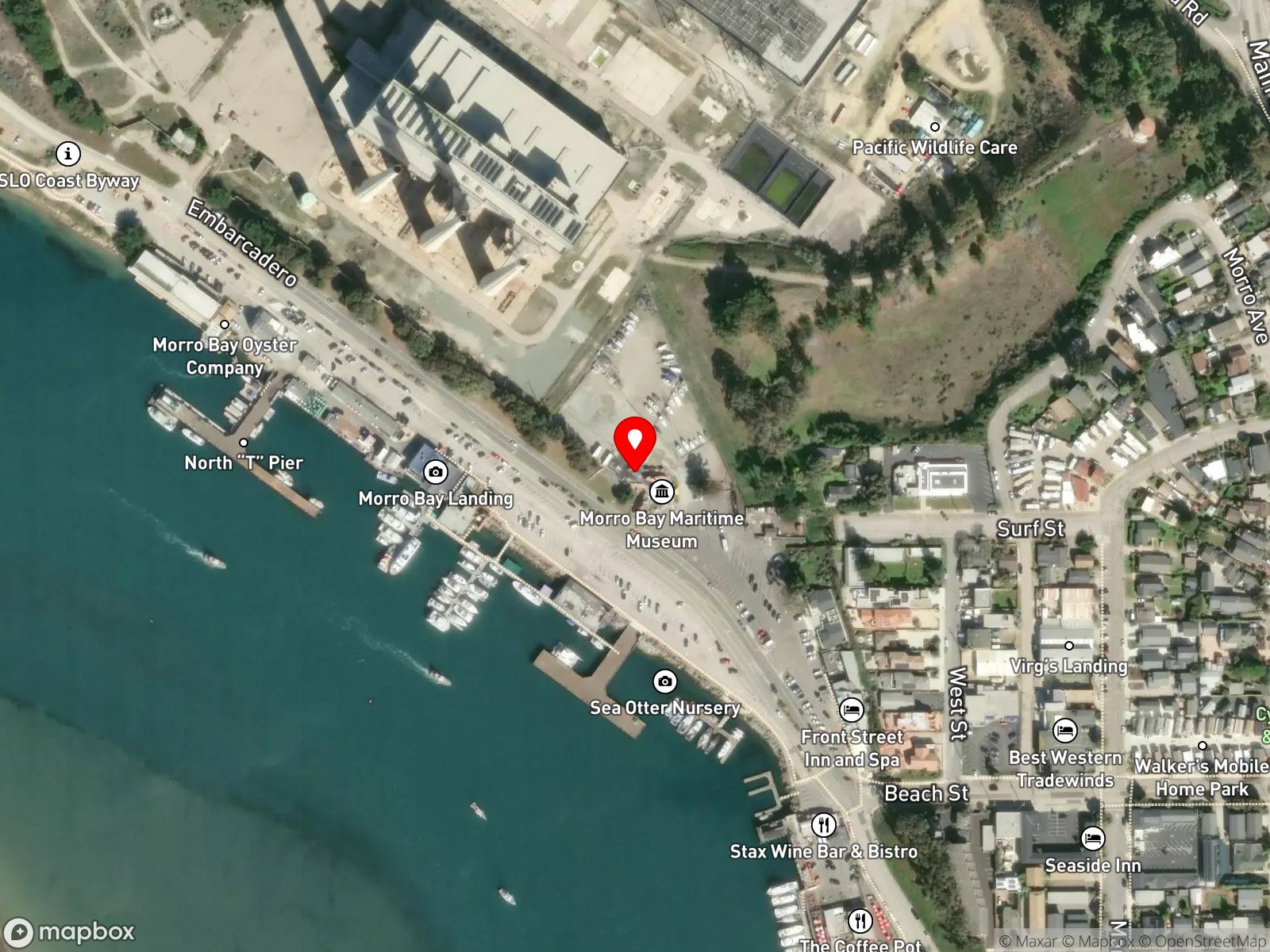
About Morro Bay North T-Pier
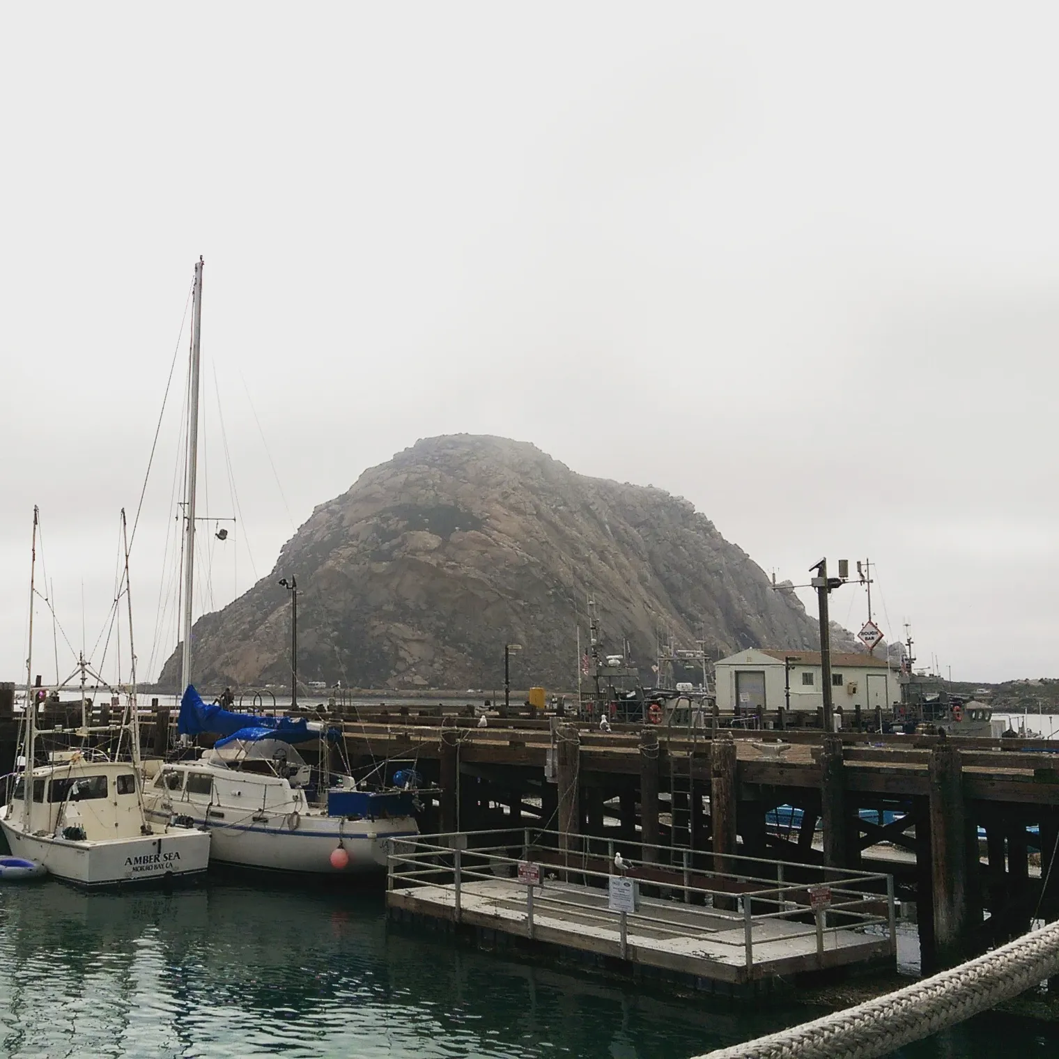
The Morro Bay North T-Pier is a public pier on the Embarcadero in Morro Bay Harbor, on the inner harbor channel directly across from Morro Rock. The pier is shaped like a T, with a long approach extending out from shore and a perpendicular crossbar at the seaward end. Coast Guard, harbor patrol, and commercial fishing vessels work from the structure. Divers occasionally enter the water beneath the pilings to inspect the macro life growing on the wood.
The dive site is the pier itself: pilings driven into the harbor bottom, in roughly 10 to 20 feet of water at high tide, dense with encrusting growth. The harbor channel at this spot has reduced wave energy and tidal exchange, making the location a bay biome. The pilings and the adjacent riprap form a hard-substrate community typical of harbor pier dives, adding a rocky reef biome. Both biomes are reachable on the same dive without leaving the pier footprint.
The dive site is slack-tide only. The harbor channel rips on incoming and outgoing tides, and divers who attempt the pier on a moving tide are pushed out under boat traffic. Divers must check in with the Morro Bay Harbor Department before entering the water and stay under the pier, clear of the active boat lanes. Scuba diving is the only activity here. The pier is too short and too close to active boat traffic for hook-and-line fishing to be a focus, and spearfishing is prohibited.
Free and metered street parking is available along the Embarcadero, with some metered spots near the harbor. Hook-and-line fishing from the pier is permitted with a California fishing license. Spearfishing is prohibited under California Code of Regulations Title 14 § 1.88, which closes the area within 1,000 feet of any public pier, and the dive site is the pier. The harbor separately prohibits spearfishing around docks, piers, and active boat lanes.
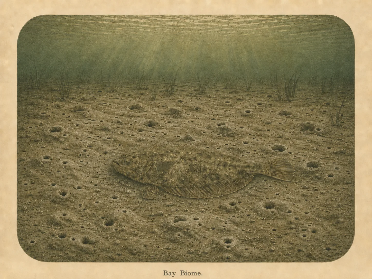
Bay
The bay biome is sheltered, low-energy water behind a jetty, headland, or harbor mouth. Reduced wave action lets fine sediment settle out and supports calm-water species and the juveniles that shelter there. Learn more about this biome and the species found in it by clicking the link below.
Learn more in the Biome Glossary
Rocky Reef
The rocky reef biome is bare rock, boulder, and cobble structure without a kelp canopy above it. The hard relief and its crevices shelter invertebrates and reef fish, and the structure concentrates life that the surrounding sand cannot hold. Learn more about this biome and the species found in it by clicking the link below.
Learn more in the Biome GlossaryTarget Fish Species
Nearby beaches
 Surf Zone
Gain the Power
of the Oracle.
Ocean Oracle sees the future. Get 7-day visibility forecasts for every beach, plus alerts the night before clarity peaks — so you never miss a prime day.
Free shows you what the ocean looks like today. Ocean Oracle shows you the week ahead and the fish waiting for you down there.
Visibility predictions for the entire week ahead at any beach. Plan dives, schedule charters, book trips — without guessing.
The night before any beach hits prime conditions, Ocean Oracle pings your phone. Wake up knowing exactly where to go.
Track your favorite beaches in one place. Forecasts and alerts for everywhere you dive.
For every beach: what species are there, when they show up, and how to target them. Built by spearos, for spearos.
See the future. Dive on the right days.