
Ocean Beach
San Diego · San Diego County · California

Did you dive today?Please share the visibility to make our algorithm more accurate.
Report visibilityToday's forecast
Updated 6:06 AM PT today · July 28, 2026Dawn is the clearest window — afternoon onshore wind builds chop and stirs the sand bottom through the heat of the day. River-mouth influence at the north end can hurt visibility after rain.
7-Day Forecast
Map · getting there
32.748° N · 117.252° W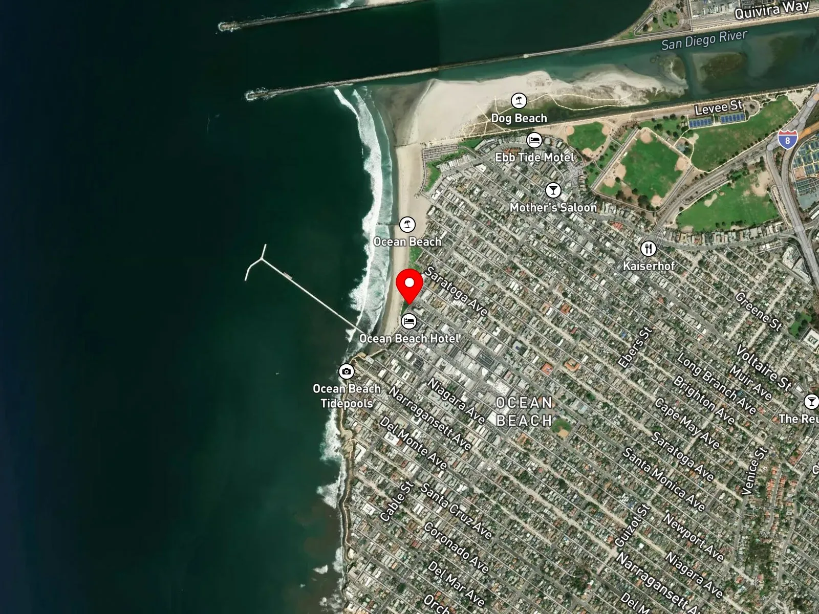
San Diego, CA 92107
About Ocean Beach
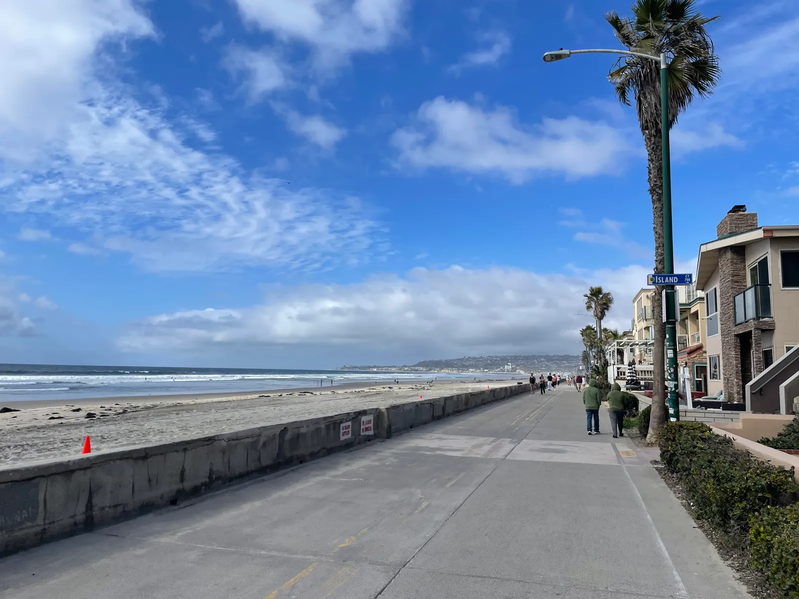
Ocean Beach sits at the mouth of the San Diego River, immediately north of the Point Loma peninsula. The Ocean Beach Pier extends 1,971 feet from the foot of Newport Avenue, ending in a T-shape, and is the longest concrete pier on the west coast of the United States. Storm damage closed the pier to public access in 2024, and the City of San Diego is moving toward replacement rather than repair. Newport Avenue dead-ends at the pier and runs east through a strip of shops and restaurants. At the north end of the beach, Dog Beach was one of the first off-leash beaches established in San Diego and is bounded by the San Diego River jetty. At the south end, the Ocean Beach Tide Pools sit against the base of the Sunset Cliffs and come into reach at low tide.
The bottom is sand across the named beach, with the small intertidal rock outcrops at the south end as the only exception. The breaking surf over that sand bottom makes this a surf zone biome.
Surfing dominates the water, with lifeguarded swimming through the warmer months and steady hook-and-line surf fishing alongside it. The lack of rocky structure or kelp on the main beach keeps spearfishing, snorkeling, and scuba uncommon, though the rocks at the south end draw tide-poolers at low water.
Several free public lots serve the beach: 110 spaces at the foot of Newport Avenue next to the Ocean Beach Pier, 68 at the foot of Santa Monica Avenue next to the main lifeguard station, plus the lots at the foot of Voltaire Street and at Dog Beach. All of them fill on summer weekends, and the metered street parking on the residential blocks is plentiful when the lots are gone. Spearfishing is prohibited within 1,000 feet of the Ocean Beach Pier under California Code of Regulations Title 14 Section 1.88, and the rule applies whether or not the pier is open to the public. Outside that exclusion, fishing and spearfishing are legal under standard California regulations.

Surf Zone
The surf zone biome consists of sandy beaches and breaking waves. The action of surf disturbing the sand and kicking it up exposes marine invertebrates, buried in their shallow dens. This natural exposure of invertebrates attracts all kinds of fish, looking for an easy meal. Learn more about this biome and the species found in it by clicking the link below.
Learn more in the Biome GlossaryTarget Fish Species
Nearby beaches
Gain the Power
of the Oracle.
Ocean Oracle sees the future. Get 7-day visibility forecasts for every beach, plus alerts the night before clarity peaks — so you never miss a prime day.
Free shows you what the ocean looks like today. Ocean Oracle shows you the week ahead and the fish waiting for you down there.
Visibility predictions for the entire week ahead at any beach. Plan dives, schedule charters, book trips — without guessing.
The night before any beach hits prime conditions, Ocean Oracle pings your phone. Wake up knowing exactly where to go.
Track your favorite beaches in one place. Forecasts and alerts for everywhere you dive.
For every beach: what species are there, when they show up, and how to target them. Built by spearos, for spearos.
See the future. Dive on the right days.