
Solimar Beach
Solimar · Ventura County · California

Did you dive today?Please share the visibility to make our algorithm more accurate.
Report visibilityToday's forecast
Updated 10:00 AM PT today · July 28, 2026Dawn is the clearest window — onshore wind picks up by late morning and surface chop stirs the bottom through the afternoon.
7-Day Forecast
Map · getting there
34.304° N · 119.348° W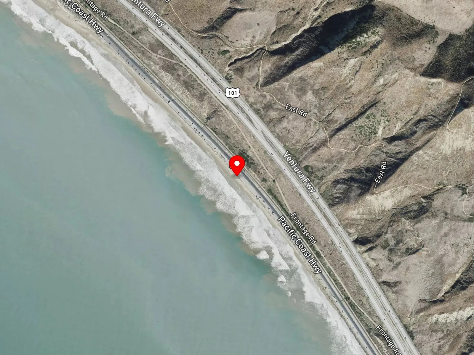
Ventura, CA 93001
About Solimar Beach
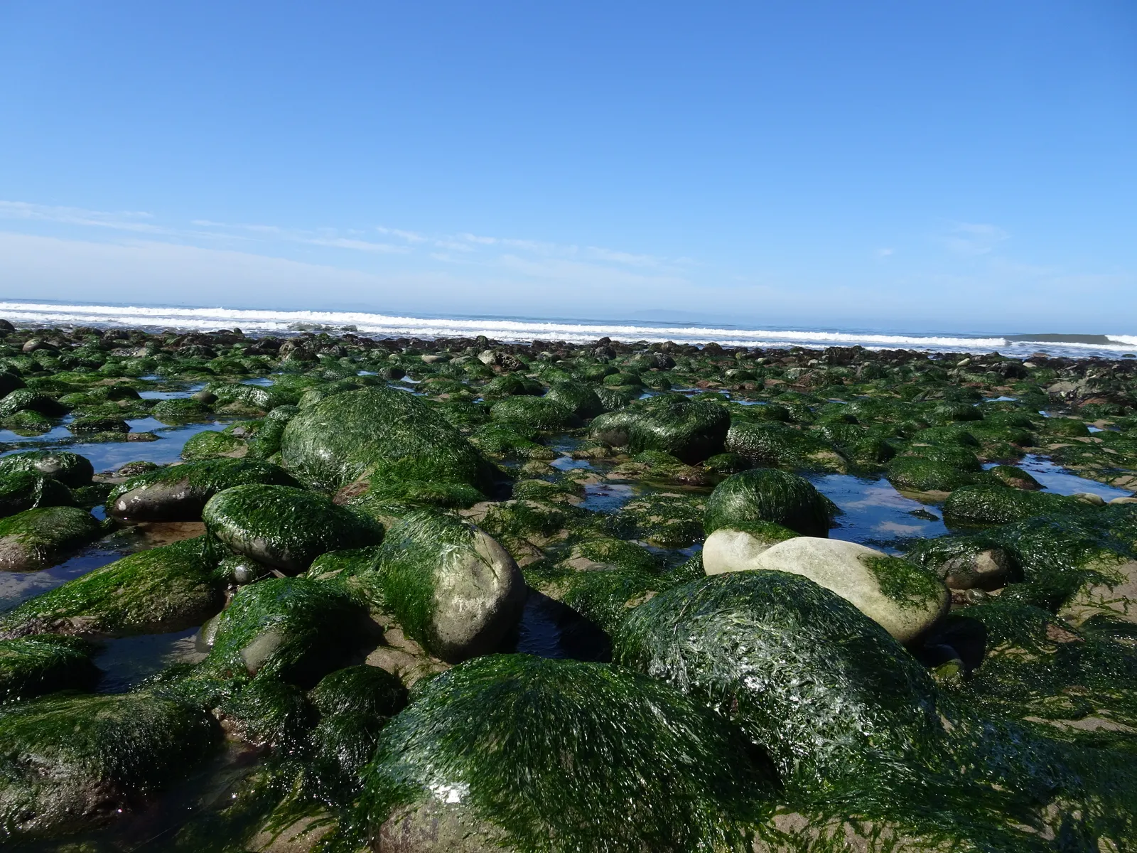
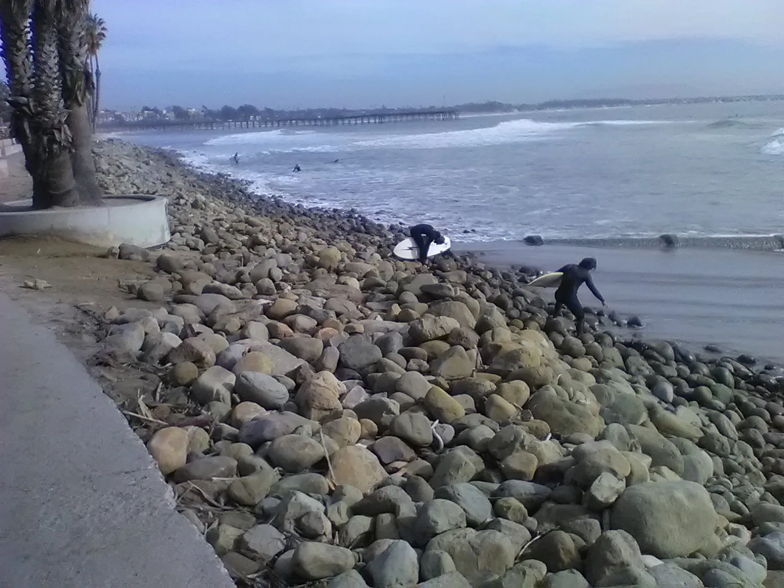
Solimar Beach runs along Pacific Coast Highway about four miles north of downtown Ventura. The beach is narrow and the highway shoulder sits immediately inland of the sand. Most of the beach fronts the Solimar Beach Colony, a private gated residential community with two gates, east and west, that is closed to non-residents. The southern portion is open to the public, because no houses sit at that end and the sand is accessible from the highway shoulder. At the south end of the public segment, Solimar Reef, also called Solimar Point, is a triangular sand and cobble setup that produces a left point break on south and southwest swells at medium-to-high tides.
The cobble and sand shoreline with its breaking waves at the public segment is a surf zone biome. The triangular cobble and reef structure at Solimar Reef, with its low relief and patchy substrate, forms a rocky reef biome at the point itself.
Surfing at the public south end and at Solimar Reef is the dominant water use, and shore anglers work the cobble for surfperch. The limited relief of the inshore structure keeps snorkeling, scuba, and spearfishing uncommon.
Limited free shoulder parking lies along Pacific Coast Highway next to the public segment, and there are no restrooms on site. Non-residents cannot enter the Solimar Beach Colony itself. Fishing and spearfishing are legal on the public sand and the offshore water under standard California regulations.

Surf Zone
The surf zone biome consists of sandy beaches and breaking waves. The action of surf disturbing the sand and kicking it up exposes marine invertebrates, buried in their shallow dens. This natural exposure of invertebrates attracts all kinds of fish, looking for an easy meal. Learn more about this biome and the species found in it by clicking the link below.
Learn more in the Biome Glossary
Rocky Reef
The rocky reef biome is bare rock, boulder, and cobble structure without a kelp canopy above it. The hard relief and its crevices shelter invertebrates and reef fish, and the structure concentrates life that the surrounding sand cannot hold. Learn more about this biome and the species found in it by clicking the link below.
Learn more in the Biome GlossaryTarget Fish Species
Nearby beaches
Gain the Power
of the Oracle.
Ocean Oracle sees the future. Get 7-day visibility forecasts for every beach, plus alerts the night before clarity peaks — so you never miss a prime day.
Free shows you what the ocean looks like today. Ocean Oracle shows you the week ahead and the fish waiting for you down there.
Visibility predictions for the entire week ahead at any beach. Plan dives, schedule charters, book trips — without guessing.
The night before any beach hits prime conditions, Ocean Oracle pings your phone. Wake up knowing exactly where to go.
Track your favorite beaches in one place. Forecasts and alerts for everywhere you dive.
For every beach: what species are there, when they show up, and how to target them. Built by spearos, for spearos.
See the future. Dive on the right days.