
Faria Beach Park
Pitas Point · Ventura County · California

Did you dive today?Please share the visibility to make our algorithm more accurate.
Report visibilityToday's forecast
Updated 10:00 AM PT today · July 28, 2026Dawn is the clearest window — onshore wind picks up by late morning and surface chop stirs the bottom through the afternoon.
7-Day Forecast
Map · getting there
34.319° N · 119.390° W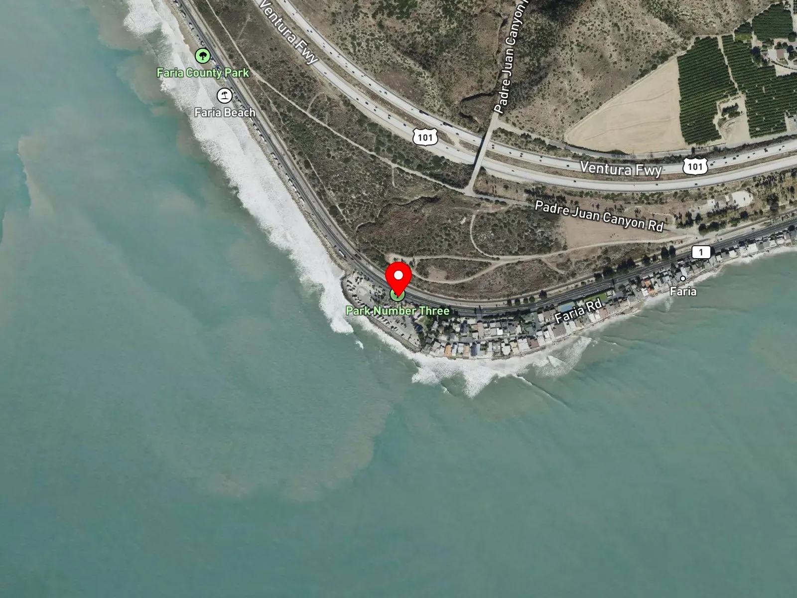
Ventura, CA 93001
About Faria Beach Park
Faria Beach Park sits 7 miles north of Ventura on Pacific Coast Highway, at the cobble shoreline that wraps the headland known as Pitas Point. Among surfers, the park and the break are often called Pitas Point or Pitas Point/Faria County Park. Ventura County Parks operates the day-use area and the 42-site campground at 4350 Pacific Coast Highway, with 17 full-hookup sites. The beach is narrow and shifts between cobble and sand. At the south end, the point forms a rocky reef and produces a peeling right and left point break that holds on west and northwest swells through fall and winter.
The cobble and sand entry with breaking waves is a surf zone biome. At and just offshore of the point, the exposed rocky structure and cobble, with barnacle-encrusted boulders at the foreshore, is a rocky reef biome reached on foot at low tide and by short swim at higher tides.
Surfing at Pitas Point is the dominant water activity, with intermediate-level peeling waves on quality days. Shore anglers work the cobble for surfperch, and summer swimming is common at the sandier sections. Snorkeling around the point structure is uncommon, and the limited relief of the inshore structure keeps scuba and spearfishing uncommon as well.
Ventura County Parks operates the day-use lot with a posted fee, and campsites can be reserved through the county. The lot fills on summer weekends. Fishing and spearfishing are legal here under standard California regulations.

Surf Zone
The surf zone biome consists of sandy beaches and breaking waves. The action of surf disturbing the sand and kicking it up exposes marine invertebrates, buried in their shallow dens. This natural exposure of invertebrates attracts all kinds of fish, looking for an easy meal. Learn more about this biome and the species found in it by clicking the link below.
Learn more in the Biome Glossary
Rocky Reef
The rocky reef biome is bare rock, boulder, and cobble structure without a kelp canopy above it. The hard relief and its crevices shelter invertebrates and reef fish, and the structure concentrates life that the surrounding sand cannot hold. Learn more about this biome and the species found in it by clicking the link below.
Learn more in the Biome GlossaryTarget Fish Species
Nearby beaches
Gain the Power
of the Oracle.
Ocean Oracle sees the future. Get 7-day visibility forecasts for every beach, plus alerts the night before clarity peaks — so you never miss a prime day.
Free shows you what the ocean looks like today. Ocean Oracle shows you the week ahead and the fish waiting for you down there.
Visibility predictions for the entire week ahead at any beach. Plan dives, schedule charters, book trips — without guessing.
The night before any beach hits prime conditions, Ocean Oracle pings your phone. Wake up knowing exactly where to go.
Track your favorite beaches in one place. Forecasts and alerts for everywhere you dive.
For every beach: what species are there, when they show up, and how to target them. Built by spearos, for spearos.
See the future. Dive on the right days.