
Avila Beach
San Luis Obispo · San Luis Obispo County · California

Did you dive today?Please share the visibility to make our algorithm more accurate.
Report visibilityToday's forecast
Updated 10:00 AM PT today · July 28, 2026Dawn is the clearest window — onshore wind picks up by late morning and surface chop stirs the bottom through the afternoon.
7-Day Forecast
Map · getting there
35.178° N · 120.732° W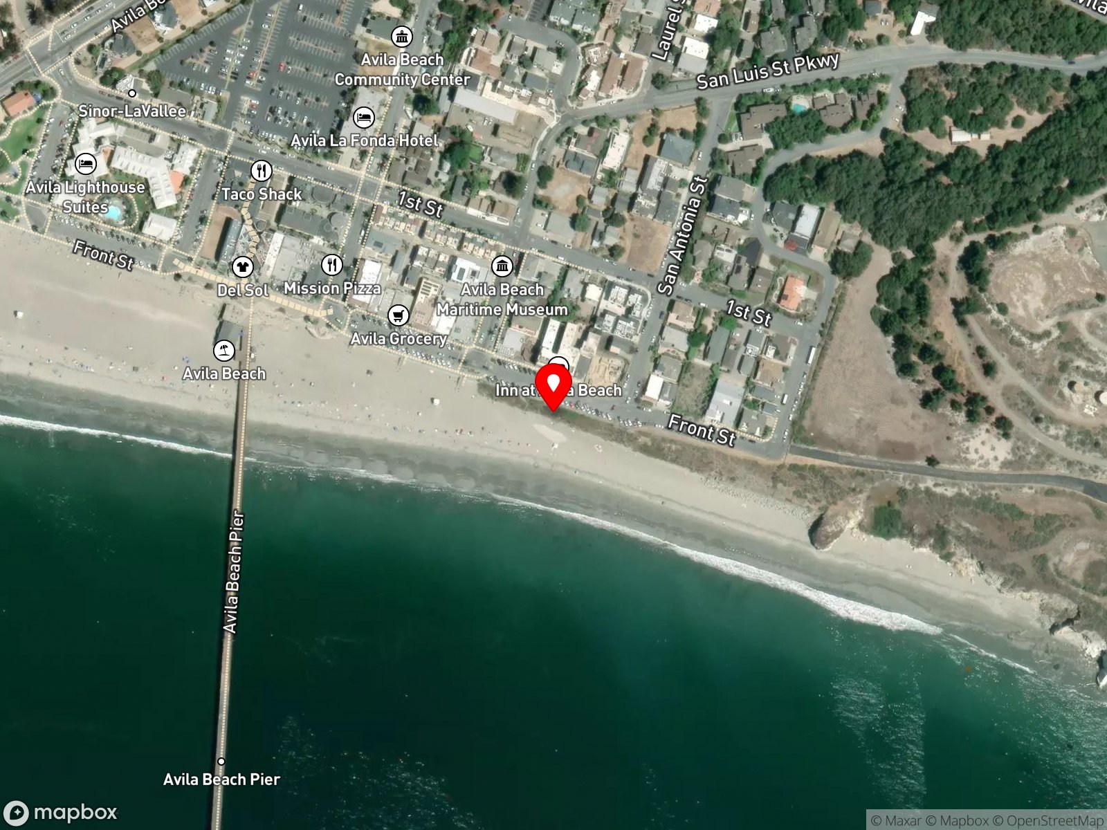
About Avila Beach
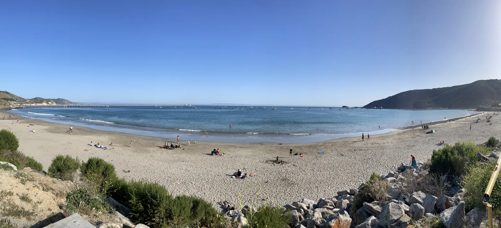
Avila Beach is a half-mile crescent of sand on the inside of San Luis Bay, with the town promenade running directly above the shoreline. Point San Luis sits to the southwest and takes the prevailing northwest swell and wind off the beach before either reaches the sand. The shelter shows in the water temperature, which climbs to 60 to 65 degrees in summer, among the warmest readings on the central coast. The 1,685-foot Avila Beach Pier extends south from the middle of the crescent, and a row of cafes, restaurants, and a wine collective lines the promenade above the sand.
The eastern end of the beach holds tide pools and small sea caves near the base of Front Street. Bob Jones Trail leaves the western end of the beach and runs roughly 2.5 miles inland past the San Luis Obispo Creek lagoon to a trailhead at Ontario Road off Highway 101. A planned 4.4-mile extension to downtown San Luis Obispo has not been built. Migrating gray whales are visible from the pier in winter.
The open sand and the small waves breaking across it make the central beach a surf zone biome. At the eastern end the shore transitions into a rocky reef biome at Fossil Point, where cobble and rocky structure extend into the water at the base of the cliffs.
Swimming, kayaking, and paddleboarding draw the most use, and hook-and-line fishing is common from the pier (no license required) and from the shore. Snorkeling at the Fossil Point rocks is feasible on calm days. The sheltered geography keeps surfing uncommon, and there are no reports of shore scuba diving here.
Paid public lots along Front Street and 1st Street, plus metered street parking nearby, fill on summer weekends, though free residential parking opens up a few blocks inland. Hook-and-line fishing is legal under standard California regulations. Spearfishing is prohibited within 1,000 feet of any public pier under California Code of Regulations Title 14 § 1.88, and the 1,000-foot exclusion zone around the Avila Beach Pier covers most of the crescent. Spearfishing is legal only at the far western end near the San Luis Obispo Creek lagoon and Bob Jones Trail, and at the far eastern end near Fossil Point.

Surf Zone
The surf zone biome consists of sandy beaches and breaking waves. The action of surf disturbing the sand and kicking it up exposes marine invertebrates, buried in their shallow dens. This natural exposure of invertebrates attracts all kinds of fish, looking for an easy meal. Learn more about this biome and the species found in it by clicking the link below.
Learn more in the Biome Glossary
Rocky Reef
The rocky reef biome is bare rock, boulder, and cobble structure without a kelp canopy above it. The hard relief and its crevices shelter invertebrates and reef fish, and the structure concentrates life that the surrounding sand cannot hold. Learn more about this biome and the species found in it by clicking the link below.
Learn more in the Biome GlossaryTarget Fish Species
Nearby beaches
Gain the Power
of the Oracle.
Ocean Oracle sees the future. Get 7-day visibility forecasts for every beach, plus alerts the night before clarity peaks — so you never miss a prime day.
Free shows you what the ocean looks like today. Ocean Oracle shows you the week ahead and the fish waiting for you down there.
Visibility predictions for the entire week ahead at any beach. Plan dives, schedule charters, book trips — without guessing.
The night before any beach hits prime conditions, Ocean Oracle pings your phone. Wake up knowing exactly where to go.
Track your favorite beaches in one place. Forecasts and alerts for everywhere you dive.
For every beach: what species are there, when they show up, and how to target them. Built by spearos, for spearos.
See the future. Dive on the right days.