
Thornhill Broome Beach
Point Mugu · Ventura County · California

Did you dive today?Please share the visibility to make our algorithm more accurate.
Report visibilityToday's forecast
Updated 10:00 AM PT today · July 28, 2026Dawn is the clearest window — onshore wind picks up by late morning and surface chop stirs the bottom through the afternoon.
7-Day Forecast
Map · getting there
34.078° N · 119.042° W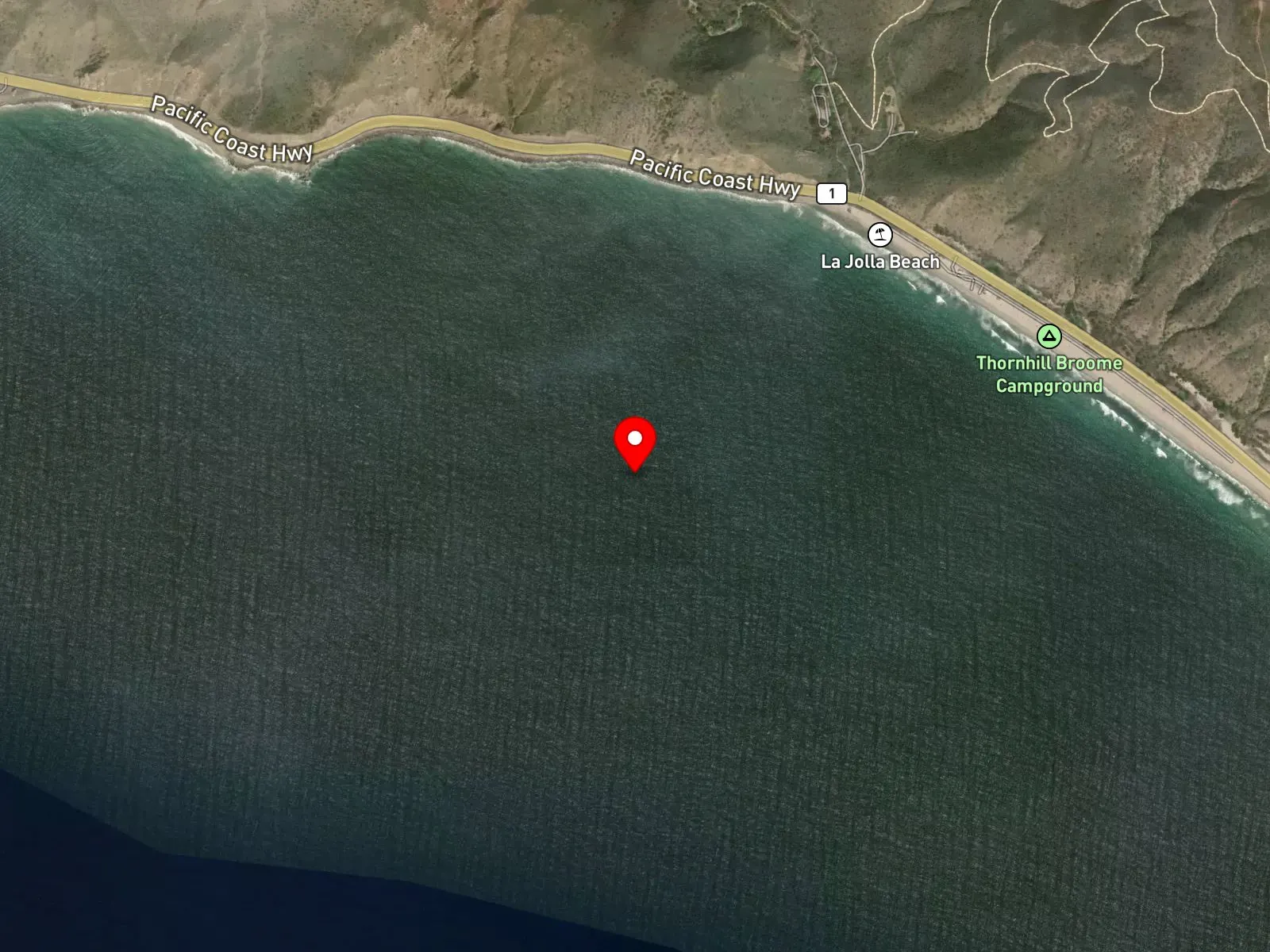
Point Mugu, CA 93042
About Thornhill Broome Beach
Thornhill Broome Beach is the beachfront campground at the northern end of Point Mugu State Park, formerly known as La Jolla Beach and renamed for Mary Thornhill Broome. The campground runs as a single line of roughly 70 reservable sites along the shoulder of Pacific Coast Highway, set on a narrow strip between the highway and the sand. Each site has a picnic table and a fire ring, and the campground is otherwise primitive: vault toilets only, with no water, no electricity, no showers, and no dump station. Reservations open six months in advance through ReserveCalifornia. The La Jolla Group Camp, inland of the highway, shares the Thornhill Broome check-in. The Big Sand Dune sits directly across Pacific Coast Highway from the campground, a steep coastal dune climb used widely as a fitness workout and as a sunset viewpoint.
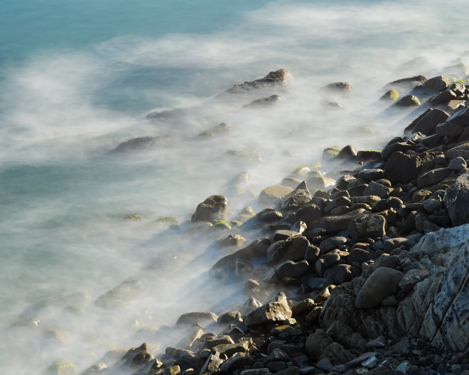
The sand bottom and breaking waves along the open beach are a surf zone biome.
Swimming concentrates in calm conditions through the summer, and shore anglers work the sand for surfperch. The beach break holds shape across moderate swell, and surfing picks up when the surf builds. No rocky structure or kelp sits offshore along the named beach, which keeps snorkeling, scuba, and spearfishing in the surf uncommon.
Reservations are essential because of high demand. Day-use parking along the shoulder is paid per the state park schedule. Fishing and spearfishing are legal here under standard California regulations. No state marine protected area covers this section of the Point Mugu coast.

Surf Zone
The surf zone biome consists of sandy beaches and breaking waves. The action of surf disturbing the sand and kicking it up exposes marine invertebrates, buried in their shallow dens. This natural exposure of invertebrates attracts all kinds of fish, looking for an easy meal. Learn more about this biome and the species found in it by clicking the link below.
Learn more in the Biome GlossaryTarget Fish Species
Nearby beaches
Gain the Power
of the Oracle.
Ocean Oracle sees the future. Get 7-day visibility forecasts for every beach, plus alerts the night before clarity peaks — so you never miss a prime day.
Free shows you what the ocean looks like today. Ocean Oracle shows you the week ahead and the fish waiting for you down there.
Visibility predictions for the entire week ahead at any beach. Plan dives, schedule charters, book trips — without guessing.
The night before any beach hits prime conditions, Ocean Oracle pings your phone. Wake up knowing exactly where to go.
Track your favorite beaches in one place. Forecasts and alerts for everywhere you dive.
For every beach: what species are there, when they show up, and how to target them. Built by spearos, for spearos.
See the future. Dive on the right days.