

The Weekend that San Diego Became The Bahamas: Why Did the Visibility Reach 60 Feet and Will it Happen Again?
From October 16 to 19 the visibility at La Jolla Shores climbed from 40 feet to 60, the lifeguard scale maxed out, and the explainer Nautical Nick posted about it passed 1 million views. Here is what lined up to make it happen, why the same water came back 2 weeks later, and what El Niño means for the next one.
At 8 a.m. on Sunday, October 18, a diver swam out from La Jolla Shores, past the surf line, past the sand dollar beds, and kept going until the bottom dropped into the canyon. The water never went green. The report that came in afterward read 60 feet in the open water outside the break, 15 feet in the surf zone, and 20 feet as the honest number for the beach as a whole. By 3 p.m. the open-water figure had been revised to 65. Nautical Nick founder Nick Meyers, who filed both, called it the clearest water he had seen in his life.
Nobody argued. The San Diego lifeguards' morning report for the Shores, which tops out at 20 feet because their scale stops there, read 20. A diver on the San Diego scuba Facebook group wrote that the shallows were "easy 50'+ visibility" and a bit murkier below 40 feet. A second Nautical Nick member logged 60 at the break and 60 outside it. A report relayed from the SpearFactor community called it "50+ crystal clear" from the Shores to the sand dollar beds, the canyon, the Marine Room's deep reef, and the shallows in front of the hotels, hazy only out at the buoys. The same day, a report from the Coronado Islands read 60 to 80 feet, 71 degrees Fahrenheit (22 degrees Celsius), and no thermocline, the sharp temperature layer that normally separates warm surface water from the cold below.
How it built
The week did not start that way. A weak storm dropped about half an inch of rain on La Jolla between October 11 and 13, and the lifeguards' October 13 report put the Shores at 5 feet, poor, with 5-foot waves and moderate surge. A Nautical Nick note from the 12th described a milky band of sediment hugging the beach with clearer turquoise water outside it, and the Scripps Pier turbidity sensor, which measures how much suspended material is in the water, had settled from 4.47 to 0.64 units by the 12th.
Then the wind turned around. Santa Ana winds, the dry offshore winds that blow from the desert toward the coast, built on October 13 and peaked on Friday, October 16, when gusts passed 80 mph at Buckman Springs and Hellhole Canyon and a heat advisory put coastal highs at 83 to 91 degrees Fahrenheit (28 to 33 degrees Celsius), according to ABC 10News. Offshore flow continued through Sunday morning. At the beach that meant almost no wind chop: the marine model Nautical Nick stores logged 1 to 8 knots of wind through the weekend, light and mostly off the land, and the swell sat at 2 to 3 feet with a 13-second period. The lifeguards logged the surf at 1.5 to 2 feet and the surge as light on every La Jolla Shores report from Friday to Sunday.
The water was also empty of the thing that usually turns it green. NOAA's satellite chlorophyll reading for the La Jolla cell, a measure of how much phytoplankton is floating in the water, sat at 0.36 to 0.39 milligrams per cubic meter from October 14 through 19, the bottom of the scale the site's model uses. Water temperature at the Shores held at 67 to 70 degrees Fahrenheit (19 to 21 degrees Celsius) on the lifeguards' thermometer all weekend.
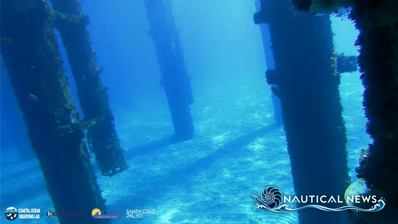
Friday, October 16, was the first big day. The lifeguards rated the Shores 15 feet and excellent. The Scripps Pier underwater camera, which Meyers grades frame by frame, read 30 feet at 7 a.m. and 42 feet by 3 p.m., and Meyers logged 40 feet in the open water with 20 feet as the overall call. A SpearFactor report from the same day put the Shores at 30 to 40, "a glass day." In Orange County, a Facebook report from Shaw's Cove in Laguna Beach read 40-plus feet in spots, "ultra clear," and Meyers logged 40 feet well outside at Treasure Island Beach.
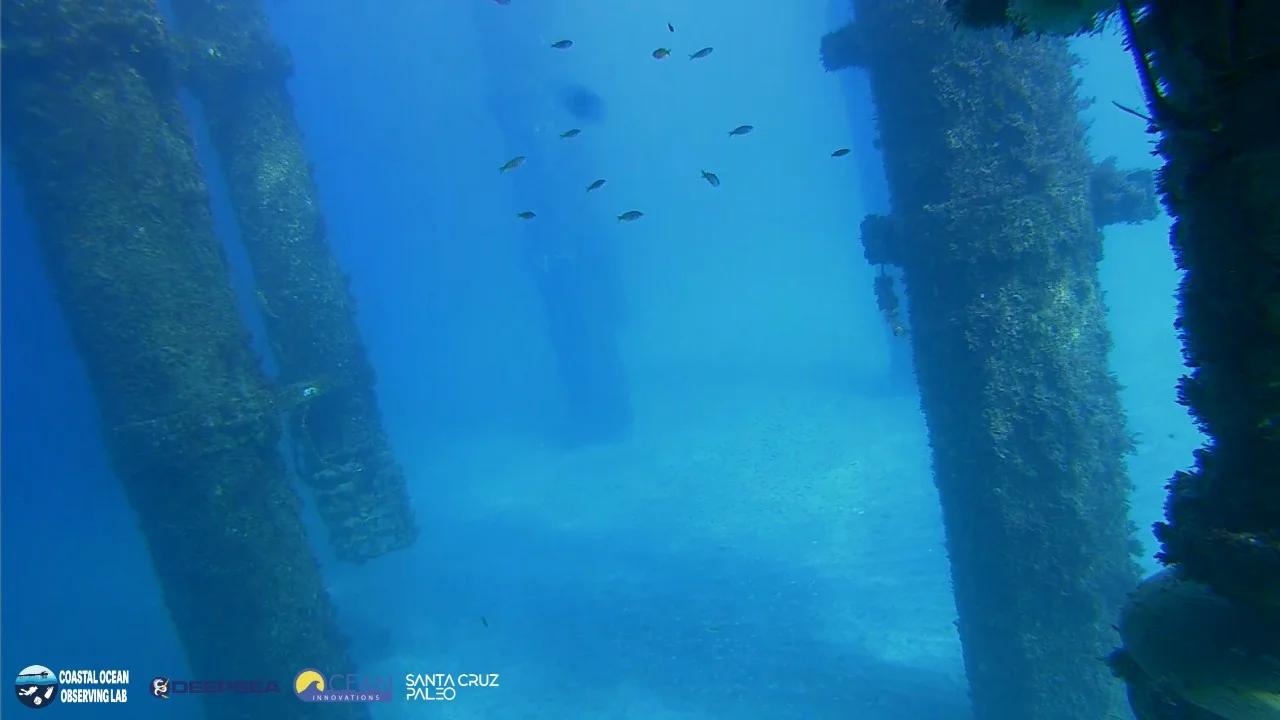 Friday, October 16, 3:01 p.m.: 42 feet. Image: Scripps Pier underwater camera, UC San Diego Coastal Ocean Observing Lab.
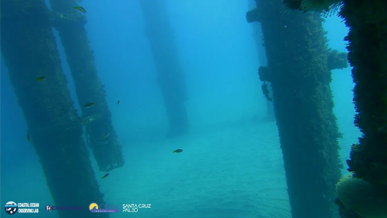 Saturday, October 17, 1:01 p.m.: 42 feet. Image: Scripps Pier underwater camera, UC San Diego Coastal Ocean Observing Lab.
Saturday held. The pier camera graded 42 feet in every frame from 7 a.m. to 5 p.m. Snorkelers who went that day told Meyers the beach and the water were crowded, and everybody in it was giddy with excitement. A Facebook diver called the Shores "swimming pool conditions, 40 ft viz," and a SpearFactor report described a turtle at 25 feet by the canyon.
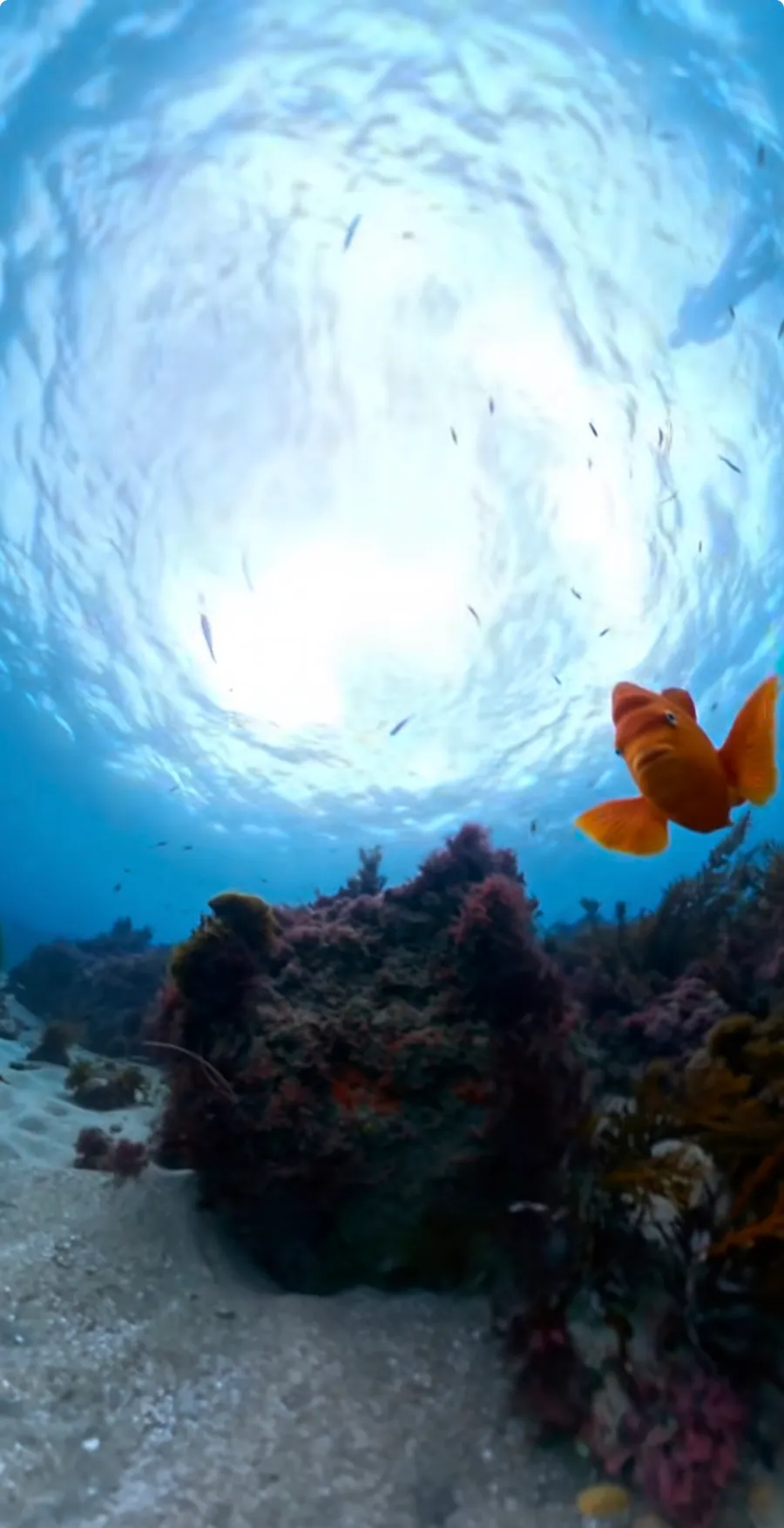 Saturday, October 17: a garibaldi over the reef, with the surface plainly visible from the bottom. Photo: Chris Hart, @lajollamorningreport
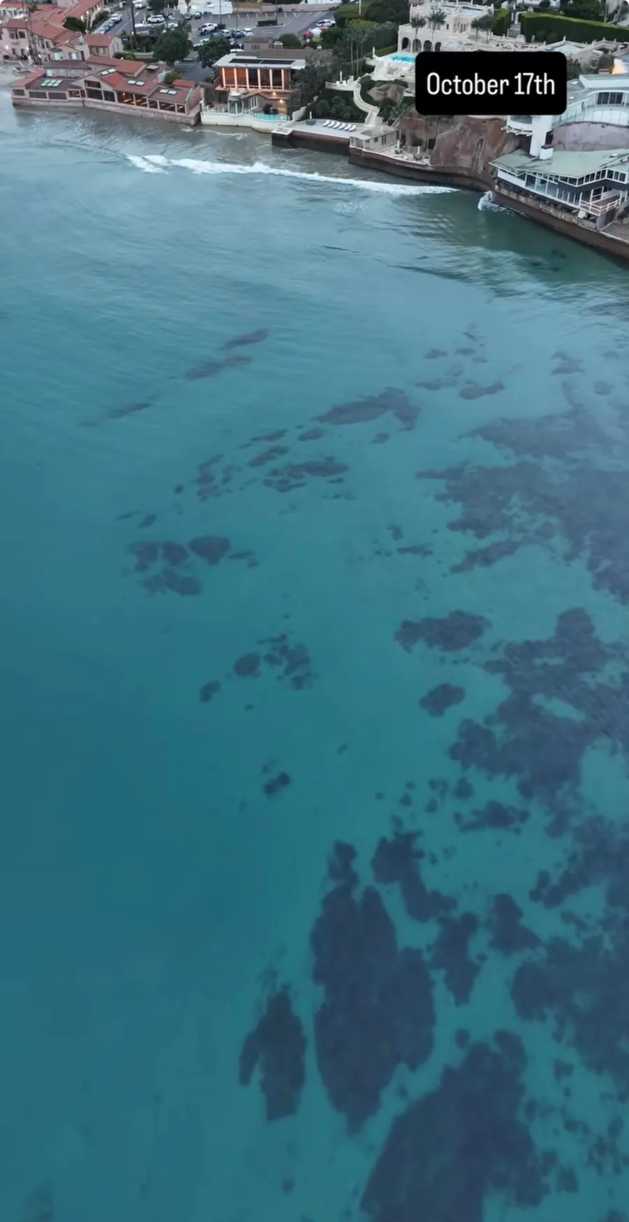 Saturday, October 17: the Marine Room reef from the air, every patch of reef plain from the surface. Photo: Chris Hart, @lajollamorningreport
Los Angeles joined in: reports from Redondo Beach and Lunada Bay on the Palos Verdes Peninsula both read 50 feet and up, "flat as a lake," 70 degrees at 65 feet of depth. Monterey was in it too, with 40 feet at the Breakwater and at Bluefish Cove, and 64 to 66 degree water that one technical diver called the warmest ever seen in the Monterey area.
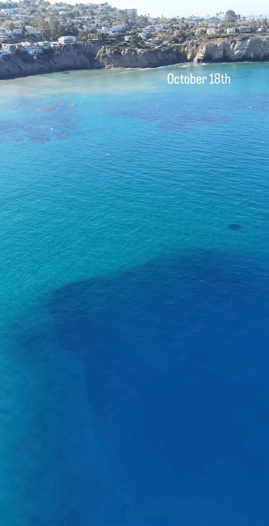 Sunday, October 18: La Jolla Canyon from the air, with people in the water near shore and the canyon edge dropping away into deep blue. Photo: Chris Hart, @lajollamorningreport
Sunday was the peak. The pier camera reached 60 feet by 11 a.m. and graded 60 again at 1 p.m. and 5 p.m. By then, word of the water had reached just about every snorkeler in San Diego. Local snorkelers told Meyers it was the most crowded they had ever seen La Jolla Shores, with hundreds of people in the water. They also described a tangible energy on the beach, a feeling of pure, raw excitement. People were giddy with happiness, in awe of the beauty, and filled with gratitude. One snorkeler overheard a stranger say, "I'm so grateful I moved to San Diego. This place is so beautiful it takes my breath away."
Monday was the start of the slide. The lifeguards logged 18 feet and good on October 19, Meyers logged 40 feet outside, and the Marine Room reef was down to 5. By Tuesday the Shores read 15 and a Facebook report from the Marine Room read 3 feet near shore. A cold Pacific storm arrived Wednesday.
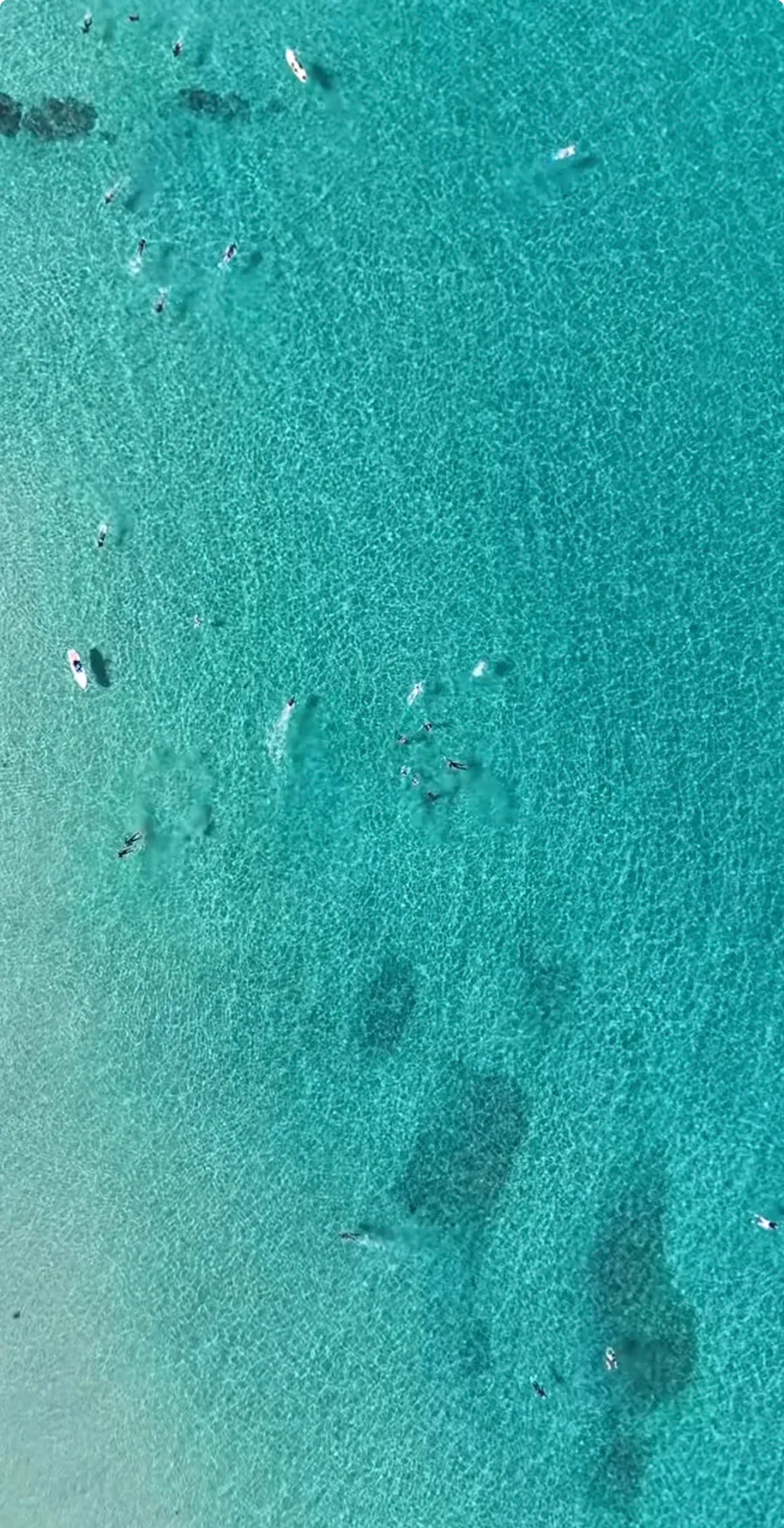 Sunday, October 18: snorkelers over the sand at La Jolla Shores. Photo: Chris Hart, @lajollamorningreport
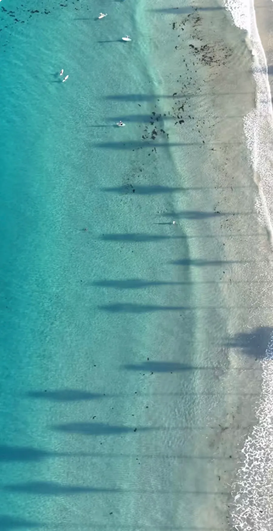 Sunday, October 18: paddleboarders off La Jolla Shores, with long morning shadows across the water. Photo: Chris Hart, @lajollamorningreport
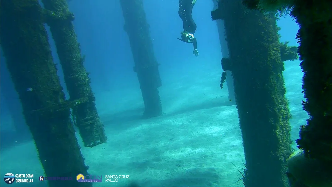 Sunday, October 18, 1:01 p.m.: 60 feet, with a diver in the frame. Image: Scripps Pier underwater camera, UC San Diego Coastal Ocean Observing Lab.
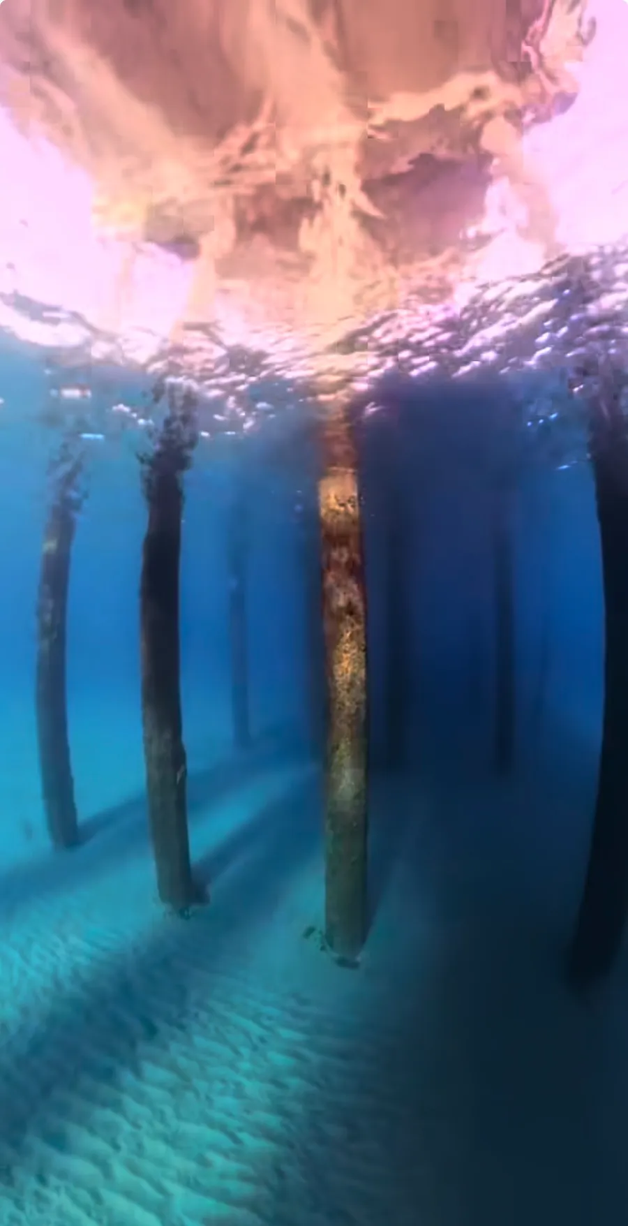 Sunday, October 18: under Scripps Pier, the rows of pilings and the rippled sand clear to the back of the frame. Photo: @sandyeggosurf
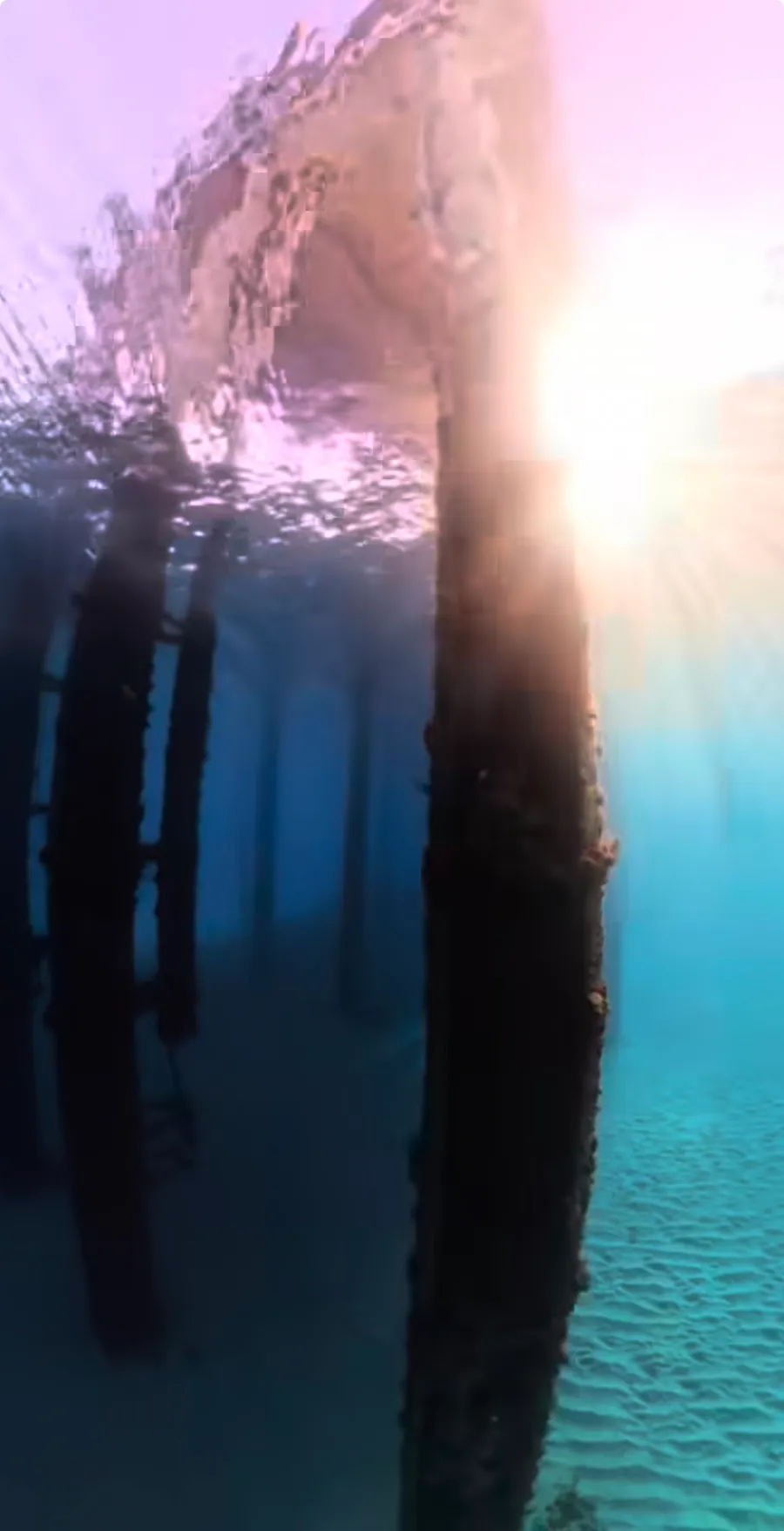 Sunday, October 18: sun through the surface beside a Scripps Pier piling. Photo: @sandyeggosurf
Not everywhere
The same weekend was poor on the beaches that face the surf. Laguna Beach's Main Beach lifeguards logged 10 feet on Friday, then 0 to 5 on Saturday and 0 to 2 by Monday, with 3 to 4 foot waves from Saturday on and moderate surge every day. La Jolla Cove's inside water stayed at 3 to 5 feet in member reports even while the water outside the cove read 40, which is the usual split there: the cove's shallow bowl holds the sand the surge stirs up. At Crescent Bay in Laguna a SpearFactor report put the south end at 0 and Seal Rock at 15 to 30 on the same morning. Clear water in Southern California is a question of where the surge is, and that weekend the surge was in Orange County.
The part that went viral
Meyers posted 3 reels about the water. The first, on Friday the 16th, was a 45-foot report built on the Scripps camera and the site's visibility cards. The second, Sunday evening, walked through every zone in drone footage by Chris Hart of the La Jolla Morning Report, pier to canyon, with the biome tags and the visibility number on screen, and was posted as a collaboration with Hart's page. The third, Monday morning, explained why the water had gone clear. By October 22 the explainer alone had 1,056,000 views, 66,600 likes, and 33,100 shares, and it has since passed 1.1 million. The zone-by-zone report had 283,000 views, and the account had gone from about 600 followers to 4,836. Several news outlets reached out, CBS 8 San Diego among them with an interview request. Hundreds of the comments asked the same question, where the visibility reports came from, and the answer was the forecast page most of the viewers had never heard of.
Nautical Nick's own forecast under-called the weekend. Its published number for the Shores on October 17 and 18 ran 19 to 24 feet against observed water of 40 to 60, which is on the record in the site's calibration log alongside the reports it missed. Since November 12, the forecast starts each day from the newest nearby diver report when no camera frame applies, and its open-water numbers follow a curve fitted to real open-water readings. The lifeguards' 20 is the other side of the same problem: the scale was built for a coast where 20 feet is a great day, and on October 18 it was not enough.
Will it happen again?
It already has, once. On October 31 and November 1, the water off La Jolla Shores cleared to the same mark. The pier camera graded 60 feet on both days. A diver on the San Diego scuba Facebook group measured 45 feet across the bottom on the morning of the 31st, another reported 50-plus feet from the pier all the way to the Marine Room, and Meyers logged 60 feet well outside the break on November 1. In more than 100 days of camera grades since July, those are the only 3 days to reach 50 feet: October 18, October 31 and November 1.
The second time came without the Santa Anas. The sea was calm again, but no offshore wind blew that week. Instead, a band of warm, salty water moved onto the coast overnight on October 30. The automated sensors on Scripps Pier read 75 degrees Fahrenheit (24 degrees Celsius) on October 31, the warmest October day in a record that starts in 2013, and a hand sample read 75.4 degrees at both the surface and the bottom. What the 2 events shared was an empty ocean. The pier's chlorophyll sensor, which measures the microscopic plants that turn water green, logged its 4 lowest daily readings between mid-June and the start of November on October 17, October 18, October 31 and November 1.
The second run ended within an afternoon. The wind on November 1 was light until late morning and reached 22 mph by 1 p.m. The camera dropped from 60 feet at 11 a.m. to 40 by 3 p.m., and the pier's turbidity sensor, which counts the particles floating in the water, rose about 20 times over by 5 p.m. as the chop stirred up the bottom.
The empty-ocean half of the recipe has a good chance of holding this winter. NBC 7 San Diego reported that October brought the clearest ocean water in more than 10 years, and that Scripps scientists traced it mainly to a shortage of plankton. The unusually warm ocean, the station reported, held back upwelling, the rise of cold, nutrient-rich deep water that normally feeds it. A 2019 Scripps-led modeling study of El Niño and La Niña along the California coast found the same pattern, with fewer nutrients and less plankton during El Niño and more of both during La Niña. NOAA expects this El Niño to stay strong to very strong through January to March, and an experimental NOAA forecast started in October gives an 80 to 100 percent likelihood of marine heat wave conditions off California and Baja California through early 2027.
The calm-water half is harder in winter. NOAA's winter outlook favors a wetter than normal December through February across California, and NBC 7 noted that 4 of the past 5 strong or very strong El Niño seasons were wetter than normal in San Diego. Rain washes sediment off the land, and winter storms bring the swell and wind that stir up the bottom, as the afternoon chop did on November 1. The first week of November showed how fast that can happen. With south and west swells running, the lifeguards' reading at the Shores fell to 8 to 15 feet from November 4 to 8. Santa Ana winds can still flatten the sea on the right week, and they typically blow from fall through winter and into early spring, according to NBC 7. The likeliest answer for the rest of this season is short windows: the warm, empty water stays, and the clear days come when a calm spell lasts long enough after a storm for the water to settle.
After El Niño, the odds change. La Niña, the cool opposite phase, often follows a strong El Niño. NOAA's ENSO blog found that the 3 strongest El Niños since 1950 were each followed by one, though it called the overall link weak. The reason sits in the ocean itself: the same winds that build El Niño set off slow ocean waves that, months later, tend to end it. If La Niña follows this one, it would bring the upwelling back, and with it the nutrients and plankton that turn Southern California water green. That would make weekends like October 18 rare again, so divers have good reason to go while the water stays warm.
Sources
Nautical Nick calibration corpus, lifeguard reports for La Jolla Shores, La Jolla Cove, Laguna Main Beach and Fletcher Cove, October 13 to 20, 2026 (San Diego and Laguna Beach lifeguard phone lines, recorded daily)
Nautical Nick member reports and relayed community reports (San Diego scuba and freediving Facebook groups, SpearFactor), October 16 to 20, 2026, stored in the site's calibration log
Nautical Nick stored inputs for La Jolla Shores: NOAA CoastWatch VIIRS satellite chlorophyll, Open-Meteo Marine swell and wind, Open-Meteo weather and 5-day rain, Scripps Pier automated shore station turbidity, October 11 to 21, 2026
ABC 10News, Megan Parry, San Diego's weather forecast for October 16, 2026: warm and windy Saturday, https://www.10news.com/weather/san-diegos-weather-forecast-for-october-16-2026-warm-and-windy-saturday
ABC 10News, Megan Parry, San Diego's weather forecast for October 19, 2026: cooling off with rain mid to late this week, https://www.10news.com/weather/san-diegos-weather-forecast-for-october-19-2026-cooling-off-with-rain-mid-to-late-this-week
Nautical Nick Instagram analytics as logged October 22, 2026, and Nick Meyers, November 16, 2026
Scripps Pier underwater camera imagery courtesy of the UC San Diego Coastal Ocean Observing Lab, frames graded by Nick Meyers, October 16 to 18, 2026, https://coollab.ucsd.edu/pierviz/
Nautical Nick, "60ft of Vis in San Diego - A Scientific Explanation on the Phenomena," YouTube Shorts, https://youtube.com/shorts/NDXZKVhoPNM
NBC 7 San Diego, Greg Bledsoe, San Diego sees signs of historic El Niño after record October, November 4, 2026, https://www.nbcsandiego.com/news/local/historic-october-hints-at-historic-el-nino/4096655/
Nautical Nick analysis of the Scripps Pier automated shore station (Southern California Coastal Ocean Observing System) and Scripps Pier camera grades, October 16 to November 1, 2026 (docs/analysis-2026-10-31-clear-water-mass.md and docs/analysis-2026-10-31-salinity-history.md), with waves from CDIP buoy 46254 and wind from NOAA station LJPC1
Cordero-Quirós, N., Miller, A.J., Subramanian, A.C., Luo, J.Y., and Capotondi, A., "Composite physical-biological El Niño and La Niña conditions in the California Current System in CESM1-POP2-BEC," Ocean Modelling 142 (2019), https://doi.org/10.1016/j.ocemod.2019.101439
GV Wire, Anthony W. Haddad, Will El Niño bring a wetter winter to California? NOAA says the odds are rising, October 30, 2026 (NOAA 2026-27 Winter Outlook and Climate Prediction Center), https://gvwire.com/2026/10/30/will-el-nino-bring-a-wetter-winter-to-california-noaa-says-the-odds-are-rising/
NOAA Physical Sciences Laboratory, Marine Heatwave Forecast, initialized October 2026, accessed November 16, 2026, https://psl.noaa.gov/marine-heatwaves/
NOAA Climate.gov ENSO blog, Will La Niña follow El Niño? What the past tells us, January 28, 2016, https://www.climate.gov/news-features/blogs/enso/will-la-niña-follow-el-niño-what-past-tells-us
NBC 7 San Diego (City News Service), Santa Ana winds and fire danger in San Diego County, December 8, 2024, https://www.nbcsandiego.com/news/local/santa-ana-winds-fire-danger-san-diego-county/3695276/